Country:
 City:
City:


The walk starts at Piazzale Roma. This square is the terminus for several bus routes, including those arriving from Marco Polo Airport. It is also a major stop on the Vaporetto service (lines 1, 2, 3, 4.1, 4.2, 5.1, 5.2 and 6).
The names of the routes are written on the walls in large black letters on a white background. In the description below, the names of the routes and the main monuments are written in Italian – that is, as they appear on site – and in italics. See the list of routes in the ‘Practical Information’ section.
(S/E) Head towards the south-east corner of the square and the bank of the Rio Nuovo, past the end of the bus park and at the foot of the Hotel Arlecchino. Then take the bridge over the Canale Burchielle (which comes from the right) but do not cross the Rio Nuovo. Leave the Hotel Arlecchino on your right, follow the Fondamenta de Ca’ Bernardo and walk alongside the Rio Nuovo on your left (restaurant terraces).
(1) Ignore a bridge on the left and take the bridge opposite. Continue along the Rio dei Tre Ponti. At the end, take the bridge opposite which spans the Rio de la Cazziola. After a few metres, cross a metal bridge. At the Fork in the road that appears immediately, take the middle path, Calle de Corte Contarini. Walk past the university library on your right, then pass under two porticoes. Cross another canal, continue along Calle del Forno and emerge onto a large square, Campo de Santa Margherita.
(2) Turn right, passing a rectangular building on your left and a flagpole topped with the Lion of St Mark. Walk past a large white building on your right (Scuola Grande dei Carmini) until you reach a side entrance to the church of Santa Maria dei Carmini. Then turn left onto a narrow path (signposted‘Osteria’). After passing the apse of the church, cross a canal. Immediately after the bridge, turn left and walk alongside the canal on your left. Continue in this direction until you reach Campo San Barnaba (with the church opposite).
(3) Turn right and enter the Sotoportego del Casin dei Nopile. Cross a canal, continue straight ahead, ignoring a bridge on the left. Stay on the main street, veering first left then right. Turn left as the street narrows. Finally, cross the Ponte de le Maravegie.
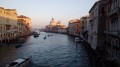
(4) Walk along the right-hand side of the Rio de San Trovaso. Pass the church of the same name on the opposite bank, then a traditional gondola workshop. You’ll reach the banks of the very wide Canale della Giudecca, with the island of the same name opposite and, in the distance to the right, the ferry terminal and the commercial port.
Turn left and follow the quay with the canal on your right. Pass the churches of Santa Maria della Visitazioneand Santa Maria del Rosario in turn. At the corner of the latter, turn left and emerge onto a pretty square next to the church of Santa Agnese. Turn right, leaving the church on your left and the Swiss Consulate on your right. Just before a small canal, turn right into a passageway called Sotoportego del Pistor.
Reach the Canale della Giudecca, turn left and cross a small perpendicular canal. Continue along the quay, cross another small canal, walk past the former Ospedale degli incurabili and then a small church, and cross one final small canal.
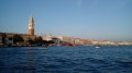
Then turn left onto the Fondamenta de Ca’ Balà and walk alongside the small canal on your left. At numbers 336 and 337 on the opposite bank, turn right at the corner by a restaurant. You’ll come out onto a small square; turn right onto Rio Terra Ai Saloni and walk alongside the arcades on your right. Back at the edge of the Canale della Giudecca, turn left and follow the quay to the Punta della Dogana (superb view straight ahead on the left of St Mark’s bell tower and the Doge’s Palace).
(5) Turn left at the tip and walk along the Grand Canal on your right. Walk past the church of Santa Maria della Salute. Turn slightly left and then take the first bridge (wooden) on the right, just to the right of the apse of the church of San Gregorio. After the bridge, go through a passageway under a building. At the small square that follows, turn right, passing a well on your left. Follow Calle del Bastion, ignoring the side paths.
At the end, cross a bridge over a small canal and continue along a narrow path. Turn left along this path and you’ll come out onto a small square. Cross it diagonally to the right (do not take the bridge) then turn right (do not enter the Molin passage). Walk alongside a canal on your right and note the Peggy Guggenheim Museum on the opposite bank. At the end, turn right onto the Ponte del Formager. As you leave the bridge, turn left onto Calle della Chiesa (to reach the museum, turn right).
Once you reach Campo San Vio (with access to the Grand Canal on the right), head slightly left and cross the bridge over a small canal. Continue straight ahead, ignoring a path on the left and then one on the right. At the T-junction, turn right. Then turn left and head up to the right to the top of the Ponte dell’Academia over the Grand Canal (a lovely viewpoint).
(6) Retrace your steps and, as you come down from the bridge, turn right. Walk past the entrance to the Accademia, then take a path on the right towards Piazza Roma. Make a left-right zigzag and, at the end of the path, turn left. You’ll come back to the Ponte delle Maraviglie, which you crossed earlier.
(4) Cross the canal via the bridge and follow the route you took on the way there in the opposite direction: carry on straight ahead, ignore an alleyway on the right and turn right with the street, ignore further alleyways on the right, walk alongside a canal on your right, cross a bridge, pass under some arcades and emerge onto Campo San Barnaba.
(3) Walk past the Church of San Barnaba on your right and turn right onto the bridge of the same name. Continue straight ahead into Calle delle Boteghe. Ignore a path on the left, turn right and take the first left (no. 3281 on the left-hand side). Carry on straight ahead until you reach a square, cross it diagonally to the right, pass the central plane tree and continue along Calle Foscari. Cross the bridge over the river of the same name and carry on straight ahead.
Turn into the first left, towards Ferrovia, and at the junction with a very narrow path, carry on straight ahead. Ignore a path on the left and then turn into the first left, at the corner of No. 3764. Go round the Church of San Pantalon on the left and emerge onto the campo of the same name. Then turn left onto the Ponte Foscari. Carry on straight ahead to Campo Santa Margherita.
(2) At the corner of No. 2977, turn right into Calle del Forno – which you took on the way there – towards “Piazzale Roma”. Cross a canal and, at the end of the bridge, turn right and walk alongside the canal on your right. At the end, turn left. Walk alongside a canal on your right and ignore two bridges on the right in succession. At the end, cross a canal coming from the left.
(1) As you come off the bridge, turn right, follow the Rio Nuovo on your right, cross a canal running perpendicular to it, and you’ll find Piazzale Roma on your left (S/E).

 Visorando Member