Along the Seiche

A short hike between ponds and following the Seiche river.

Details

512652
Creation:
Last update:
Last review:
  • Walking
    Activity: Walking
  • ↔
    Distance: 5.93 mi
  • ◔
    Average duration: 2h 45 
  • ▲
    Difficulty: Easy

  • ⚐
    Back to start: Yes
  • ↗
    Ascent: + 20 ft
  • ↘
    Descent: - 20 ft

  • ▲
    Highest point: 98 ft
  • ▼
    Lowest point: 59 ft

Photos

Description of the walk

Park behind the Chartres-de-Bretagne swimming pool, near "Halles de la Conterie", street "Rue Léo Lagrange".

(S/E) From the starting point, take "Avenue d'Orson" to reach the little mine path and turn left.

(1) When you reach the Seiche river, leave the GR® on the right and take the path on the left (blue markings). Cross the bridge under the highway "Autoroute des Estuaires" and follow the Seiche along the cycle path (be careful).

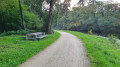
(2) Near the sewage treatment plant, let the cycle path go straight ahead and take the small path on the right as close as possible to the Seiche river. Cross a small wooden bridge (picnic table nearby). When you reach a metal bridge, use it to cross the Seiche and continue straight ahead until you reach the street "Route de la Seiche". Turn right towards the Pâtissel and immediately take the street "Chemin des Cours Crues" on the right, just before a house.

(3) Let the path go straight ahead and follow the blue markings to the left, then left again 300m further on. The path winds through fields to reach a small road.

(4) Take the road to the right and continue straight on until you reach the road near the hamlet of La Salle, where you fork right.

(5) Turn left immediately after the metal railing and follow the narrow path between a field and a row of fir trees. Continue straight on to the road near "Touche Eon" and turn right. Pass over the Autoroute des Estuaires and then Les Landelles.

(6) At the cross (la Croix), turn right onto the small road of La Bulotière. When you reach another road, turn left and continue to the end of the road. At the Planche crossroads, turn right and cross the bridge over the Seiche river.

(7) Don't miss the little staircase on the right, and continue along the path alongside the Seiche, opposite the staircase (picnic tables on the right).

(8) Continue along the Seiche river (blue markings).

(1) Leave the first path on your left (the path you took to the start of the hike) and continue as far as the crow's-foot, where you leave the path that passes under the freeway "Autoroute des Estuaires" bridge. Turn left onto the cycle path alongside the freeway and continue straight ahead until you reach road "Chemin d'Orson", which you turn left onto. Leave the road "Chemin de la Conterie" on your left.

(9) Turn left into the street "Rue Léo Lagrange" just before the swimming pool, and a hundred metres further on you'll reach the start car park. (S/E)

Waypoints

  1. S/E : mi 0 - alt. 79 ft - Halles de la Conterie
  2. 1 : mi 0.33 - alt. 66 ft - Seiche (rivière)
  3. 2 : mi 0.73 - alt. 66 ft - Path on the right
  4. 3 : mi 1.4 - alt. 66 ft - Bifurcation
  5. 4 : mi 1.83 - alt. 66 ft - Right at the road
  6. 5 : mi 2.12 - alt. 75 ft - La Salle
  7. 6 : mi 3.08 - alt. 79 ft - La Croix
  8. 7 : mi 3.81 - alt. 66 ft - Stairs
  9. 8 : mi 4.4 - alt. 62 ft - Along the Seiche
  10. 9 : mi 5.73 - alt. 92 ft - Rue Léo Lagrange
  11. S/E : mi 5.93 - alt. 79 ft - Halles de la Conterie

Notes

(2) Picnic tables
(7) Picnic tables

Always be cautious and plan ahead when you're outdoors. Visorando and the author of this route cannot be held responsible for any accidents occurring on this route.

The GR® and PR® markings are the intellectual property of the Fédération Française de Randonnée Pédestre.

Reviews and comments

4 / 5
Based on 24 reviews

Reliability of the description
4 / 5
Ease of following the route
4.2 / 5
Route interest
3.7 / 5
User 26051075

Overall rating : 1.7 / 5

Date of your route : Nov 06, 2025
Reliability of the description : ★★☆☆☆ Disappointing
Ease of following the route : ★☆☆☆☆ Very disappointing
Route interest : ★★☆☆☆ Disappointing
Very busy route : No

Uninteresting walk, dangerous section: crossing a double interchange. You walk too close to the RN 137 during the week and can hear it a lot. Section between 2 and 4 poorly signposted.

Machine-translated

christianphi
christianphi

Overall rating : 4.3 / 5

Date of your route : Apr 09, 2025
Reliability of the description : ★★★★★ Very good
Ease of following the route : ★★★★☆ Good
Route interest : ★★★★☆ Good
Very busy route : No

Nice circuit for running, unfortunately, part of it in the woods is full of brambles and sometimes drowned in mud. To be done in drier weather.

Machine-translated

nitch35
nitch35

Overall rating : 3 / 5

Date of your route : Aug 12, 2024
Reliability of the description : ★★★★☆ Good
Ease of following the route : ★★★★☆ Good
Route interest : ★☆☆☆☆ Very disappointing
Very busy route : No

Don't forget your machete!
Path not maintained.
300 metres of bramble bush to cross.

Machine-translated

mimilasorciere
mimilasorciere

Overall rating : 2 / 5

Date of your route : May 16, 2022
Reliability of the description : ★★☆☆☆ Disappointing
Ease of following the route : Not used / Not applicable
Route interest : ★★☆☆☆ Disappointing
Very busy route : No

Hello, would it be possible to mention the distance in metres between two strategic points? Twice on this route we've made pointless return trips because we have no idea of the next point in terms of distance.
- on the other hand, the four-lane road that cuts across the route can be heard from very, very far away before and after you pass it, it's very, very unpleasant - and the route itself, apart from the Seiche, which has a path made less pleasant by the noise of the cars, isn't very interesting - so we didn't come back very satisfied with it.
so we didn't come away very satisfied - but that won't stop us from trying another one.
thank you
have a nice day
monique

Machine-translated

patavern
patavern

Overall rating : 4.7 / 5

Date of your route : Oct 10, 2021
Reliability of the description : ★★★★★ Very good
Ease of following the route : ★★★★★ Very good
Route interest : ★★★★☆ Good
Very busy route : No

I did this route with a GPS track.
Very good, varied route.
However, I think the route would be nicer the other way round as I was a bit disappointed to finish along the 4 lanes with the noise of the cars.

Machine-translated

sfonlupt
sfonlupt

Overall rating : 4.3 / 5

Date of your route : Aug 23, 2021
Reliability of the description : ★★★★★ Very good
Ease of following the route : ★★★★☆ Good
Route interest : ★★★★☆ Good
Very busy route : No

A very rural walk, right from the start. We highly recommend it. Very well signposted, with the EXCEPTION of the "let the path go straight on" passage, given that it bends to the right and that the path to take on the left is really grassy, so hasn't been trodden for... X time, with no signs and little maintenance (perhaps the torrential rain of recent months). That said, it's still passable. Many thanks to Visorando for this really enjoyable hike, which can be completed in 2? hours.tar(star)star: NB: There's nothing to see in particular, just enjoy the countryside.

Machine-translated

Philippe 1
Philippe 1

Overall rating : 3.3 / 5

Date of your route : Jun 24, 2021
Reliability of the description : ★★☆☆☆ Disappointing
Ease of following the route : ★★★★☆ Good
Route interest : ★★★★☆ Good
Very busy route : No

Interesting route for people from Rennes, but signposting deficiencies causing orientation problems

Machine-translated

gverron
gverron

Overall rating : 3.3 / 5

Date of your route : Feb 21, 2021
Reliability of the description : ★★★★☆ Good
Ease of following the route : ★★★★☆ Good
Route interest : ★★☆☆☆ Disappointing
Very busy route : No

A walk with a wide variety of paths, some wide and passable by bike, some very muddy, some noisy near the 4 lane road. A short section on the road is a little dangerous if you're going with children. There are a few nice stretches, though.

Machine-translated

Simbud
Simbud

Overall rating : 2.3 / 5

Date of your route : Jul 20, 2020
Reliability of the description : ★☆☆☆☆ Very disappointing
Ease of following the route : ★★☆☆☆ Disappointing
Route interest : ★★★★☆ Good
Very busy route : No

Impossible to follow most of the route, as the paths and/or crossings have been removed in the meantime. You can still follow the route by joining and following the nearby signposted paths. I took this option after losing 15 minutes at 2 junctions.

Machine-translated

gerard payelle
gerard payelle

Overall rating : 4.7 / 5

Date of your route : Jun 08, 2020
Reliability of the description : ★★★★☆ Good
Ease of following the route : ★★★★★ Very good
Route interest : ★★★★★ Very good
Very busy route : Yes

Not very easy to find the circuit at first, then very good

Machine-translated

Tithu
Tithu

Overall rating : 4.3 / 5

Date of your route : Jan 25, 2020
Reliability of the description : ★★★★☆ Good
Ease of following the route : ★★★★☆ Good
Route interest : ★★★★★ Very good

Excellent, first part a bit sporty and then back to calm on the towpath
Circuit in this loop, good distance

Machine-translated

jroger35
jroger35

Overall rating : 3 / 5

Date of your route : Jun 24, 2019
Reliability of the description : ★★★★☆ Good
Ease of following the route : ★★★★☆ Good
Route interest : ★☆☆☆☆ Very disappointing

hello between point 3 and 4 the path is not very good with a lot of undergrowth
otherwise the rest of the route is OK, some of the markers are not very visible, otherwise it's a fairly easy walk

Machine-translated

Giraud1
Giraud1

Overall rating : 4.3 / 5

Date of your route : May 06, 2019
Reliability of the description : ★★★★☆ Good
Ease of following the route : ★★★★★ Very good
Route interest : ★★★★☆ Good

There are three places where markers should be present

Machine-translated

eeliviso
eeliviso

Overall rating : 4.3 / 5

Date of your route : Feb 04, 2019
Reliability of the description : ★★★★☆ Good
Ease of following the route : ★★★★★ Very good
Route interest : ★★★★☆ Good

Thank you for this lovely walk along the banks of the Seiche, which is perfectly maintained for everyone (cyclists, wheelchair users, families), and the slightly "wilder" part, which is even quite muddy!
As already mentioned, crossing the RN 137 (between points 5 and 6) requires vigilance, particularly with groups or children.

Machine-translated

emmamanonjulieevan
emmamanonjulieevan

Overall rating : 5 / 5

Date of your route : Nov 13, 2018
Reliability of the description : ★★★★★ Very good
Ease of following the route : ★★★★★ Very good
Route interest : ★★★★★ Very good

Beautiful, well-signposted walk with very few roads, recommended as an easy route.

Machine-translated

Other walks in the area

For more walks, use our search engine .

The GPS track and description are the property of this route's author. Please do not copy them without permission.