From the white sands to the Lamotte Beuvron forest

This circular route follows white sandy paths lined with broom-covered heathland and heather-filled undergrowth, crossing numerous streams. It passes through the Lamotte Beuvron State Forest and winds its way through the beautiful villages of Vannes-sur-Cosson, Souvigny-en-Sologne and Sennely.

Details

1099669
Creation:
Last update:
Last review:
  • Mountain biking
    Activity: Mountain biking
  • ↔
    Distance: 28.06 mi
  • ◔
    Duration according to the author: 4 hrs 
  • ▲
    Difficulty: Moderate

  • ⚐
    Back to start: Yes
  • ↗
    Ascent: + 131 ft
  • ↘
    Descent: - 131 ft

  • ▲
    Highest point: 502 ft
  • ▼
    Lowest point: 384 ft
  • ⚐ Country: France
  • ⚐
    Area: Sologne
  • ⚐ City: Vannes-sur-Cosson (45510)
  • ⚑
    Start/End: N 47.71236° / E 2.212312°
  • ❏
    IGN map(s): Ref. 2220E, 2221SB, 2320O, 2321SB

  • ◶
    Type of surface:
  •  
     
     
     33% Road  34% Byway  33% Path
  • ⇧
    Bike carrying: Not specified
  • ▲
    Difficulty: Not specified
  • Hour-by-hour weather

Photos

Description of the route

Start from the car park at Vannes-sur-Cosson, on the corner of Rue de l’Église and Route d’Isdes.

(S/E) Take the Chemin des Sables, which continues from Rue de l’Église, markedGR®3Cin red and white. Initially tarmac, this path becomes a lovely forest track. Ignore the adjacent turn-offs. The route crosses a stream and then the D12 towards “Colminière 0.5km”. The deciduous forest gives way to conifers (pines and Douglas firs).

(1) At the crossroads, turn left towards “La Poustière”, cross the Cosson; the track turns left at La Courtaille, crosses a stream and then runs alongside a marsh.

(2) At the junction with a hard-surfaced track, take this track to the right towards Champ Guilbert. The forest is home to some very old chestnut trees. The route crosses the D64 (take care) and becomes tarmac, then crosses the D17 and continues opposite along a track towards “La Folie”, which it goes round, passing close to the houses. The path then becomes grassy.
Keep left at the fork in the road.

(3) Turn right at the crossroads onto a very wide grassy track that enters the State Forest. Ignore the various offshoots until you reach the “Champ Carré” Forest House. Pass the track on your left opposite the building, then keep left

(4) At the crossroads, do not take the wide grassy path opposite, but turn left onto the grassy track. This crosses the Allée de la Boulatière, then the D125 (take care); protected by two barriers on either side of the road, it is known as the “Allée du Vieux Misabran”. At the “Carrefour de la Gaulardière”, continue straight ahead and cross the Allée des Sangliers.

(5) Keep to the right, leaving the straight lane behind for a grassy path, and turn right again as you approach the “la Canne” stream to pass below the embankment of the Étang de Petit Cansle.

(6) At the “Petit Cansle” crossroads, take the path furthest to the left, then pass through the numerous junctions until you reach the D101 (take care), along which you head left for 360 metres.

(7) Leave the road and take a grassy path, barely visible, on the left.

(8) Leave the track by keeping to the right. The grassy path, which is rarely used, follows a fence, becoming overgrown with vegetation, then turns left.

(9) Turn right to go round the cultivated area, pass the “Maisonnette” farm on your right, then the four-way crossroads.

(10) Look out for the “CR” sign and turn right onto the grassy path leading in. Continue straight on at the Carrefour de la Croix des Brosses and head for the next crossroads.

(11) Turn left. At the four-way crossroads, turn right onto the path which is initially grassy and open.

(12) Turn left at the junction with the D101, Rue des Fontaines, then right onto the D126 (take care). Pass the village pond.

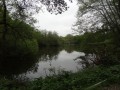
(13) Turn left towards Mondon. The track becomes tarmac and crosses the embankment of a pond. Once past Mondon, carry on straight ahead at the crossroads. Leave the lane when it turns right and continue straight ahead on the grassy path.

(14) At the crossroads, turn left onto a path bordered by a meadow on your right.

(15) Turn left, avoiding the farmyard of “La Vignette”, then immediately right onto a dyke between two ponds.

(16) Turn left onto a tarmac track, cross the D101 towards “Le Grand Cordon”.

(17) Leave the gravel track by turning left onto a grassy path, which you’ll follow until you reach the Souvigny–Vannes road. Take the track opposite. Ignore the track leading to La Brullière on your right and take the path opposite instead.

(18) Turn right at the crossroads onto the SologneGRP® (unmarked).

(19) At the ‘Milouan’ sign, turn left between the white posts (the path is not private) and pass between two ponds. Once past the entrance to the property, cross the chicane.

(20) Turn right onto the gravel track leading to the Tuilerie de l’Houan.

(21) Turn left onto Rue de Louan, then right onto Rue Creuse, heading towards Vannes (D120).

(22) Turn left towards “Maison Rouge”. Leave the track when it turns right, taking the path on the left instead.

(23) When you reach La Rougerie, take the path on the right, then follow the grassy track opposite the building. This path is poorly marked and requires the utmost care until you come to a forest track, which you should take to the right.

(24) The path runs alongside the “La Marnière” farm; turn left, then immediately right at Le Petit Bouloy.

(25) After crossing the stream, take the path on the right. This leads onto a hard-surfaced track at the “Les Bazins” farm. Turn left onto the D120.

(26) Continue straight on along the gravel track, leaving the road behind. It runs alongside Château Fraizières before curving to the right.

(27) Turn left at the four-way junction onto Route de Villemurlin.

(28) Turn left onto the D120, then left again when you see the church to return to the starting point at the end of Rue de l’Église (S/E).


Waypoints

  1. S/E : mi 0 - alt. 423 ft - Corner of Rue de l’Église and Route d’Isdes
  2. 1 : mi 4.15 - alt. 400 ft - Turn left towards “La Poustière”. Bridge over the - Cosson (rivière) - Affluent du Beuvron
  3. 2 : mi 5.76 - alt. 407 ft - Turn right towards Champ Guilbert
  4. 3 : mi 7.06 - alt. 430 ft - Turn right onto a very wide grassy track
  5. 4 : mi 7.53 - alt. 433 ft - Turn left onto the grassy track
  6. 5 : mi 8.5 - alt. 459 ft - Turn right, leaving the straight track behind you
  7. 6 : mi 8.93 - alt. 459 ft - The path furthest to the left
  8. 7 : mi 10.44 - alt. 479 ft - A barely visible grassy track on the left
  9. 8 : mi 10.91 - alt. 486 ft - Turn right, following a fence
  10. 9 : mi 11.51 - alt. 469 ft - Turn right, skirting the farmland
  11. 10 : mi 12.39 - alt. 482 ft - Turn right onto the grassy track
  12. 11 : mi 12.97 - alt. 486 ft - Turn left after the crossroads
  13. 12 : mi 14.09 - alt. 459 ft - Turn left at the junction with the D101
  14. 13 : mi 14.43 - alt. 463 ft - Turn left towards Mondon
  15. 14 : mi 16.15 - alt. 479 ft - Turn left onto a path bordered by a meadow
  16. 15 : mi 16.76 - alt. 476 ft - Turn left, avoiding the farmyard
  17. 16 : mi 17.36 - alt. 476 ft - Turn left onto a tarmac track
  18. 17 : mi 18.21 - alt. 495 ft - Turn left onto a grassy track
  19. 18 : mi 20.18 - alt. 469 ft - Turn right at the junction onto the GRP
  20. 19 : mi 20.99 - alt. 436 ft - Turn left at the ‘Milouan’ sign
  21. 20 : mi 21.37 - alt. 430 ft - Turn right when you reach the track
  22. 21 : mi 21.75 - alt. 420 ft - Turn left onto Rue de Louan, then right
  23. 22 : mi 22.36 - alt. 443 ft - Turn left towards “Maison Rouge”
  24. 23 : mi 23.14 - alt. 417 ft - Turn right, then follow the grassy path opposite the building
  25. 24 : mi 24.46 - alt. 410 ft - Turn left, then immediately right
  26. 25 : mi 25.33 - alt. 410 ft - Path on the right
  27. 26 : mi 26.3 - alt. 440 ft - Carry on straight ahead along the gravel track
  28. 27 : mi 27.17 - alt. 423 ft - Path on the right
  29. 28 : mi 27.84 - alt. 413 ft - Turn left onto the D 120
  30. S/E : mi 28.06 - alt. 427 ft - Corner of Rue de l’Église and Route d’Isdes

Notes

This route requires a good sense of direction and/or the use of a GPS track.
Watch out for signs indicating private property. There are many of them and their locations are often confusing.
When entering the State Forest, please comply strictly with the regulations of the National Forestry Office.

Some paths may be rutted by timber-hauling machinery or motor vehicles, with no regard for the environment, where access to the path is not restricted by a barrier. The route may be flooded during heavy rain, particularly between (6) and the D101.

The lack of reliable signposting, even on theGRP®, means you should exercise caution.

It is possible to stop off at Souvigny in Sologne or at Sennely.

Alternative route
By following theGRP® de Sologne between Souvigny and (18), this alternative route shortens the journey to 35.8 km, with an estimated walking time of 4–4½ hours.
(12) Coming from Rue des Fontaines, turn left in front of the church onto Rue Eugène Labiche. Turn right at the Fork in the road onto Chemin des Sentes.
The tarmac track becomes a gravel track, which you’ll leave to follow a grassy path.
(18) When you reach a cross-path coming from the right, follow the route description again.

Worth a visit

Places to see during the walk:

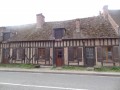
  • the villages of Souvigny-en-Sologne, Sennely and Vannes-sur-Cosson (churches with bell towers, old houses).
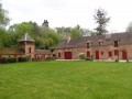
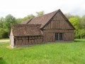
  • scattered, beautifully restored farmhouses.
  • Fraizières Castle in Vannes-sur-Cosson.
  • the Lamotte Beuvron State Forest.

Always be cautious and plan ahead when you're outdoors. Visorando and the author of this route cannot be held responsible for any accidents occurring on this route.

The GR® and PR® markings are the intellectual property of the Fédération Française de Randonnée Pédestre.

Reviews and comments

5 / 5
Based on 2 reviews

Reliability of the description
5 / 5
Ease of following the route
5 / 5
Route interest
5 / 5
jamaicansteam
jamaicansteam

Overall rating : 5 / 5

Date of your route : May 23, 2021
Reliability of the description : ★★★★★ Very good
Ease of following the route : ★★★★★ Very good
Route interest : ★★★★★ Very good
Very busy route : No

Hello,

A really lovely walking route, but some sections require a fair bit of fitness due to the many muddy and sandy paths.

We came across more animals than hikers

We’d recommend it, but do bring a packed lunch

Machine-translated

Jean-Louis Pinault
Jean-Louis Pinault

Thank you for these comments, which will be of benefit to the community.
Have a nice day,
Jean-Louis

Machine-translated

Charliemike
Charliemike

Overall rating : 5 / 5

Date of your route : Aug 19, 2020
Reliability of the description : ★★★★★ Very good
Ease of following the route : Not used / Not applicable
Route interest : ★★★★★ Very good
Very busy route : No

Thank you for this route, which we used by downloading the GPX file (onto our TOMTOM watch). It was perfect.
A flat, easy route, mostly along forest tracks. A lovely walk.

Machine-translated

For more walks, use our search engine .

The GPS track and description are the property of this route's author. Please do not copy them without permission.