Loop via Saint-Florent starting from Oletta

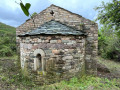
From the outskirts of Oletta, an old mule track leads to Saint-Florent across the plain. At its end stands the Cathedral of Nebbio, well worth a visit or a return visit.
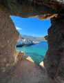
After a short detour through the vineyards of the Patrimonio appellation, which offers a superb view of the gulf and the start of Cap Corse, the walker reaches the town, its citadel and its harbour.
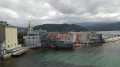
The quays, once home to fishing boats, are now home to the largest marina on the ‘Isle of Beauty’. Once you’ve crossed the Pont Neuf over the Aliso, the renovated sea wall and Roya beach reveal much more accessible attractions such as angling and swimming.
The return journey follows a rural municipal path lined with shepherds’ huts – known as ‘pagliaghji’ – built from white Saint-Florent stone.

See restrictions on use of the route in the practical information section, subject to weather conditions

Details

33768278
Creation:
Last update:
Last review:
  • Walking
    Activity: Walking
  • ↔
    Distance: 5.36 mi
  • ◔
    Average duration: 2h 45 
  • ▲
    Difficulty: Easy

  • ⚐
    Back to start: Yes
  • ↗
    Ascent: + 351 ft
  • ↘
    Descent: - 348 ft

  • ▲
    Highest point: 197 ft
  • ▼
    Lowest point: 0 ft
  • ⚐ Country: France
  • ⚐ City: Oletta (20232)
  • ⚑
    Start/End: N 42.66687° / E 9.31748°
  • ❏
    IGN map(s): Ref. 4348OT
  • Hour-by-hour weather

Photos

Description of the walk

To get to the starting car park from Oletta, take the D82 towards Saint-Florent for 5 km until you reach the roundabout at the shopping centre. Exit northwards, leaving the shopping centre on your left. Take the track opposite for 500 m and park in a clear space on the left-hand side of the track.
This hike is marked with yellow paint and cairns. French/Corsican addresses in the municipality of Saint-Florent.

(S/E) From the car park, start the hike by continuing along the track that climbs northwards.

(1) At the highest point, continue straight ahead between the posts of an old gate and begin the descent down a stony track.
(2) Continue for 100 metres, then continue downhill towards Cardoni. After an easy stretch through a clearing and then under the canopy, reach the lowest point and turn left.

(3) At the next intersection, turn right at a 90° angle onto the Pantiniccie Soprane path. Then cross the Poggio stream and continue until you reach the D238 road, a few metres from the Cathedral of Nebbio.

(4) Turn right and follow the road to the first crossroads. Turn left onto Chemin de Santa Maria and follow it until you reach the vineyards. Follow the dirt track that passes between the houses on the left and the vineyards on the right. Walk along the vineyards, turn left at the bend and continue straight ahead in a north-westerly direction to reach the highest point and the viewpoint over the Gulf of St-Florent.

(5) Take the path on the left that leads into low scrub for 200 metres. Reach the Croix du Jubilé, go down the steps, then cross the D81 road. Go up Rue Principale on the left towards the centre of Saint-Florent, reaching the crossroads at the post office.

(6) Turn right onto Rue Ernest Bonacoscia. At the end, enter the Citadel area. Walk along the esplanade overlooking the cove and the gulf, enjoying the views.

(7) Leave the esplanade via the south, taking Rue de la Citadelle and heading down towards the port. At Place Doria, pass to the right of the fountain and follow Rue de l'Église. At no. 22, enter through a gate, which is always open, onto Quai de l'Anse de la Marinuccia. This is the site of the city's ancient fishing port.

(8) Leaving No. 22, take the narrow alley opposite. Cross the street and turn left onto the Quai d'Honneur promenade, which you follow to the municipal car park. Exit onto Route de la Passerelle and turn right.

(9) After 50 metres, cross the Pont Neuf bridge on the right for a stroll along the redeveloped seawall and Roya beach. Return via the quays, lined with pine trees, to the bridge. Cross the Pont Neuf bridge again.

(10) Turn right onto Rue de l'Aliso, then follow the quays to Route du Pont de Fer. Cross the D82 in front of the gendarmerie and continue to the right to reach Chemin de Faggiolo.

(11) Turn left at the petrol station. Continue straight on for 500 metres. At the end of the tarmac road, turn right onto the dirt track called Arrechimozzo.

(12) At the second crossroads, turn right then left onto Chemin de Mercurio. Continue left along a small olive grove and, after 500 m of gentle climbing, you will return to the starting point of the circular route.

(2) Turn right and follow the same route you took on the way out to return to the car park (S/E).

Waypoints

  1. S/E : mi 0 - alt. 98 ft - Car park – Chemin du Mercurio
  2. 1 : mi 0.24 - alt. 197 ft - High point, old gate
  3. 2 : mi 0.33 - alt. 135 ft - Mercurio–Cardoni junction
  4. 3 : mi 0.68 - alt. 20 ft - Pantiniccie Soprane path
  5. 4 : mi 1.06 - alt. 36 ft - Nebbiu Cathedral – Santa Maria Assunta
  6. 5 : mi 1.44 - alt. 92 ft - Croix du Jubilé Trail
  7. 6 : mi 1.85 - alt. 46 ft - Rue Ernest Bonacoscia
  8. 7 : mi 2.23 - alt. 46 ft - Citadel
  9. 8 : mi 2.4 - alt. 3 ft - Route No. 22
  10. 9 : mi 2.67 - alt. 3 ft - Pont-Neuf
  11. 10 : mi 3.72 - alt. 3 ft - Rue de l’Aliso
  12. 11 : mi 4.18 - alt. 3 ft - Chemin du Faggiolo
  13. 12 : mi 4.66 - alt. 46 ft - Second junction – Chemin du Mercurio
  14. S/E : mi 5.36 - alt. 98 ft - Car park – Chemin du Mercurio

Notes

Restrictions: for safety reasons, the following two conditions must be met to use this route

from 15 July to 31 October 2026

* Do not use the route after 11.00 am

* Do not use the route in windy conditions

-------------------------------------------------------------------------------------------------------------------------

No drinking water points on the route.
Food and/or refreshments available: at the start and finish.
- at the shopping centre.
- at the shops near the roundabout.
During the walk:
- all shops in the centre of Saint-Florent.

Worth a visit

(S/E) Old mule track Oletta - Saint-Florent
(4) The Cathedral of Nebbiu - Santa Maria Assunta
(5) The vineyards of the Patrimonio appellation.
(5) The Jubilee Cross.
Between (6) and (7)
- The Nebbiu-Conca d'Oru Tourist Office and its completely renovated building.
- The Citadel of Saint-Florent with its viewpoints.
(7) The cove, which can be visited by going down the stairs to the right of the esplanade.
(9) The Pont Neuf bridge over the Aliso river.

Other points of interest:
- Place Doria and its fountain with frogs,
- Sainte-Anne Church,
- The site of the old fishing port,
- The current fishing port and the marina with its Quai d'Honneur,
- The redeveloped sea wall,
- The pine forest and Roya beach,
- Stroll along the public quays on the banks of the Aliso,
- Exit the town and return via the old Faggiolo path.

Reviews and comments

4.4 / 5
Based on 8 reviews

Reliability of the description
4.4 / 5
Ease of following the route
4.1 / 5
Route interest
4.6 / 5
CHJASSI DI U NEBBIU
CHJASSI DI U NEBBIU

Reply to User 28991144:

What’s so hard to understand about this detailed description?
Where exactly could you possibly get lost?
The signposting is crystal clear – please carry a can of yellow spray paint in your rucksack.
As for the rain, would you like us to set up a pumping station?
BE - NE - VO - LES – do you get the meaning?
WE HAVE NO OBLIGATION TO YOU.
If our descriptions are so bad, please stop using them; that’ll save me having to reply to you.

''(S/E) From the car park, start the walk by following the track that climbs northwards.

(1) At the highest point, continue straight ahead between the posts of an old gate and begin the descent along a stony track.
(2) Walk for 100 m, then continue the descent towards Cardoni. After an easy stretch through a clearing and then under the canopy, reach the lowest point and turn left.

(3) At the next junction, turn right at a 90° angle onto the Pantiniccie Soprane path. Then cross the Ruisseau de Poggio and continue until you emerge onto the D238 road, a few metres from the Cathedral of Nebbio.

(4) Turn right and follow the road to the first junction. Turn left onto the Chemin de Santa Maria and follow it until you reach the vineyards. Follow the dirt track that runs between houses on the left and the vineyards on the right. Walk alongside the vineyards, take a bend – keeping to the left – and head straight up towards the north-west to reach the highest point and the viewpoint over the Gulf of St-Florent.

(5) Take the path on the left which winds through low scrub for 200 m. Reach the Croix du Jubilé, go down the steps, then cross the D81 road. Head up Rue Principale to the left towards the centre of Saint-Florent, until you reach the junction by the post office.

(6) Turn right onto Rue Ernest Bonacoscia. At the end of the street, enter the Citadel grounds. Walk along the esplanade overlooking the cove and the gulf, taking in the views.

(7) Leave the esplanade via the south, taking Rue de la Citadelle, and head down towards the harbour. At Place Doria, pass to the right of the fountain and follow Rue de l’Église. At No. 22, enter through a gate – which is always open – onto the Quai de l’Anse de la Marinuccia. This is the site of the town’s ancient fishing harbour.

(8) As you leave No. 22, take the narrow alley opposite. Cross the road and turn left onto the Quai d’Honneur promenade, following it as far as the municipal car park. Exit onto Route de la Passerelle and turn right.

(9) After 50 m, cross the Pont Neuf on the right for a stroll along the redeveloped sea wall and then along Roya Beach. Return along the quays, lined with pine trees, to the bridge. Cross the Pont Neuf again.

(10) Turn right onto Rue de l’Aliso, then follow the quays until you reach Route du Pont de Fer. Cross the D82 in front of the gendarmerie and continue to the right to join Chemin de Faggiolo.

(11) Turn left onto this track at the petrol station. Continue straight on for 500 m. At the end of the tarmac road, turn right onto the dirt track known as Arrechimozzo.

(12) At the second junction of tracks, turn right then branch off to the left onto Chemin de Mercurio. Continue to the left, skirting a small olive grove, and, after a gentle 500-metre climb, you’ll return to the starting junction of the circular route.

(2) Turn right and retrace your steps along the outbound route to return to the car park (S/E).

Machine-translated

1964BB
1964BB

Overall rating : 3.7 / 5

Date of your route : Jun 23, 2026
Reliability of the description : ★★★★☆ Good
Ease of following the route : ★★★☆☆ Average
Route interest : ★★★★☆ Good
Very busy route : No

We went on this walk on Saturday 13 June 2026; it’s a lovely route that takes you through a variety of landscapes, past the town of Saint-Florent and the first vineyards of the Patrimonio.
However, the signposting could do with some improvement, as you often find yourself relying on your GPS for guidance.
There are some lovely photo opportunities in this micro-region of Corsica, which attracts many tourists every year.

Machine-translated

User 28991144
• Edited:

Overall rating : 3.7 / 5

Date of your route : May 11, 2026
Reliability of the description : ★★★☆☆ Average
Ease of following the route : ★★★☆☆ Average
Route interest : ★★★★★ Very good
Very busy route : No

The signposting is sometimes difficult to follow. Please post simpler, shorter instructions online.
On the ground, the signposting is very poor; sometimes it’s in a bad state, barely visible or even missing.
It’s easy to get lost and head in the wrong direction.
Part of the path was impassable due to the rain; it was completely flooded.
To start with, you have to park in the supermarket car park and walk along the path to the start of the hike, which is at least 500m away.
It is no longer possible to drive to the starting point.

Machine-translated

User 6087494

Overall rating : 4 / 5

Date of your route : Sep 22, 2025
Reliability of the description : ★★★★☆ Good
Ease of following the route : ★★★★★ Very good
Route interest : ★★★☆☆ Average
Very busy route : No

-

Machine-translated

User 18752664

Overall rating : 5 / 5

Date of your route : Aug 10, 2025
Reliability of the description : ★★★★★ Very good
Ease of following the route : ★★★★★ Very good
Route interest : ★★★★★ Very good
Very busy route : Yes

A pleasant walk that introduced my daughter and me to the beautiful village of St Florent.
One small comment: on 10 August 2025, the gate at number 22 was padlocked. It's very easy to get through to the other side, but I think it would be a good idea to remove it from the description as it looks like it's there to stay.
Enjoy your walk, everyone!

Machine-translated

CHJASSI DI U NEBBIU
CHJASSI DI U NEBBIU
• Edited:

Hello,
I admit that after a very long season of maintaining the hiking trails, our association has not been able to go over this route again, which you have just taken; it will be done before the end of June.
But here, when we go hiking, we always carry a pair of gloves and pruning shears in our rucksacks to deal with brambles (the grass does not obstruct the path), which are very useful, even essential.
As for the appeal of this hike, which you find very disappointing, it is a real surprise.
- from the start, you walk along the Mercurio path, which led to the town of Nebbio in Roman times
- at the end of this path, the Cathedral of Santa Maria Assunta was built in the early 12th century
- it is open to visitors and contains the shrine of Saint Flor, who is celebrated every three years on Whit Monday, but unfortunately for you, that was in 2024
- after the cathedral, you enter the vineyards of the Patrimonio appellation, where you can enjoy a superb view of the Gulf of Saint Florent from the highest point.
- then comes the town:

  • we pass through the citadel built in 1440 overlooking the sea
  • place Doria, the only square in the old village with its fountain decorated with frogs. They are traditionally eaten here on 26 July during the feast of Saint Anne
  • the nearby Sainte Anne church
  • the narrow streets of the old fishing port
  • the new marina, the largest in Corsica
  • the large shaded square and its shops
  • the new bridge and Roya beach

- finally, the return journey takes you past the old farms and their magnificent pagliaghi (shepherds' huts) built from Saint Florent white stone.
Of course, if you've missed all this, the route is of little interest.
Best regards

Machine-translated

txokolot
txokolot
• Edited:

Overall rating : 4 / 5

Date of your route : Jun 08, 2025
Reliability of the description : ★★★★☆ Good
Ease of following the route : ★★★★☆ Good
Route interest : Not used / Not applicable
Very busy route : No

Of little interest...
A passage (between points 3 and 4) completely overgrown with brambles and tall weeds

Machine-translated

CHJASSI DI U NEBBIU
CHJASSI DI U NEBBIU

Thank you, "Unknown hiker", for enjoying the route. It's always a pleasure.
Regarding parking, as the creator of itineraries with their descriptions, I can only indicate authorised public locations.
Have a great day.

Machine-translated

inconnu qui randonne

Overall rating : 5 / 5

Date of your route : May 06, 2025
Reliability of the description : ★★★★★ Very good
Ease of following the route : ★★★★★ Very good
Route interest : ★★★★★ Very good
Very busy route : No

Hello,

a pleasant, easy hike that takes you gently to Saint-Florent.
As for parking, it's easier to park at the supermarket than at the location described in the description.
It's only an extra 800 metres there and back.

Machine-translated

Frederico
Frederico

Overall rating : 4.3 / 5

Date of your route : Sep 26, 2024
Reliability of the description : ★★★★★ Very good
Ease of following the route : ★★★☆☆ Average
Route interest : ★★★★★ Very good
Very busy route : No

easy loop to follow (yellow markings and cairns) except on the Santa Maria path, where houses are under construction and a barrier blocks the way. We were able to get through by moving it. St Florent is a nice place to visit, and you could stop off at the beach

Machine-translated

clairetellier
clairetellier

Overall rating : 5 / 5

Date of your route : Apr 29, 2024
Reliability of the description : ★★★★★ Very good
Ease of following the route : ★★★★★ Very good
Route interest : ★★★★★ Very good
Very busy route : No

Very nice loop, we didn't meet anyone but the weather wasn't great

Machine-translated

Other walks in the area

For more walks, use our search engine .

The GPS track and description are the property of this route's author. Please do not copy them without permission.