The Gloriettes circular route starting from Spa

Starting from Spa railway station, this circular route takes you past three gazebos and Chawion Pond.
_ A challenging hike, as the off-track section you’ll need to tackle at one point can be quite strenuous.
_ A GPX track is required

Details

2231871
Creation:
Last update:
Last review:
  • Walking
    Activity: Walking
  • ↔
    Distance: 6.92 mi
  • ◔
    Average duration: 4h 00 
  • ▲
    Difficulty: Difficult

  • ⚐
    Back to start: Yes
  • ↗
    Ascent: + 935 ft
  • ↘
    Descent: - 958 ft

  • ▲
    Highest point: 1,171 ft
  • ▼
    Lowest point: 758 ft

Photos

Description of the walk

Get to Spa station by train, bus or car. If travelling by car, make use of the free car park.

(S/E) Take Rue de Beaurieux, at the bottom of the stairs, then turn right onto Avenue de la Reine-Astrid. At the pedestrian crossing, cross the avenue to pass under the porch of Queen Marie-Henriette’s house.
Walk through the park alongside the Horse Museum, then go round the old CPAS (public social welfare centre) building.
Turn left onto Rue Hanster, then onto Promenade des Français.

(1) At the fork in the road, turn left and walk through the Bois de Hé Fanard until you reach the junction with the Promenade de la Grande Duchesse.

(2) Take the small path on the right which winds its way up towards the stone gazebo – this is the Pavillon Bernard. Continue straight on behind it, then turn left at the junction with a wider path. You will come to a wooden gazebo.

(3) Walk through the wooden gazebo to find a path leading downhill. Follow it to reach the junction with the Chemin Marteau. Turn right onto this path and you’ll reach the Belvédère Renard.

(4) Turn left; just before the gazebo, there is a small path on the right that leads downhill.
Take care here: several trees have been uprooted by the wind, so you’ll need to go off-track at this point as the path is no longer visible and you’ll have to work your way round the fallen trees to reach the ford below. Cross it at several points depending on the season. Reach the top of the climb.

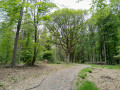
(5) Carry straight on, ignoring the various junctions to the right or left, until you reach a wide forest track.

(6) Turn left onto it and continue straight on until you reach a T-junction, the junction with the Chemin des Chasseurs.

(7) Turn right here; at the circular loop, turn left onto the Chemin du Renard. Further on, you’ll come to a junction with a footpath.

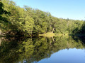
(8) Turn right onto this path and continue along the small stream until you reach the Étang de Chawion.

(9) Walk alongside the pond and then the Ru du Petit Chawion on its left bank until you reach the T-junction with Avenue de la Princesse-Clémentine; turn right here and continue to the junction marked by the forest sign.

(10) Turn right. Continue to the large junction with the Chemin du Près-du-Cerf, turn right and carry on along the Promenade Raikem or Pèlerine-voie. You will reach the junction with the Extratrail path.

(11) Turn left, following the signs for the Extratrail, until you reach the circular loop of the Promenade des Français, which you passed on the way out.

(1) Resume the shared section of the route along the Promenade des Français, then take Rue Hanster. Turn left at the former CPAS building, cross the grounds of the Maison de la Reine Marie-Henriette and head up Rue de la Gare to return to Spa station (S/E).

Waypoints

  1. S/E : mi 0 - alt. 833 ft - Spa railway station, bus stop, free car park
  2. 1 : mi 0.5 - alt. 879 ft - Junction of the circular loop
  3. 2 : mi 1.19 - alt. 928 ft - Junction with the Promenade de la Grande Duchesse.
  4. 3 : mi 1.46 - alt. 1,014 ft - Gloriette
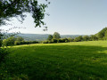
  5. 4 : mi 1.8 - alt. 935 ft - Renard Viewpoint
  6. 5 : mi 2.14 - alt. 873 ft - Top of the climb
  7. 6 : mi 2.58 - alt. 932 ft - Forest track
  8. 7 : mi 2.94 - alt. 951 ft - Chemin des Chasseurs
  9. 8 : mi 3.76 - alt. 856 ft - Crossroads: path leading to the pond
  10. 9 : mi 4.26 - alt. 899 ft - Chawion Pond
  11. 10 : mi 5.18 - alt. 1,070 ft - Forestry signs
  12. 11 : mi 6.14 - alt. 1,171 ft - Follow the Extratrail signs
  13. S/E : mi 6.92 - alt. 833 ft - Spa railway station, bus stop, free car park - Gare ferroviaire et arrêt de bus

Notes

(9) Chawion Pond: there is a small shelter where you can take a break.
- Avenue de la Princesse-Clémentine is a dirt track about as wide as a forestry vehicle.
- Walking boots.
- Walking poles for those who use them.
- Gaiters in winter.

Worth a visit

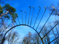
There are three gazebos or pavilions along the route which can be used as shelters and rest stops.
A viewpoint at the Pavillon Renard offering a view of the village of Marteau, and a shelter and a bench at the Étang de Chawion.

I’ve classified this hike as difficult because the off-track section you have to tackle at one point can be quite challenging.

Reviews and comments

4.7 / 5
Based on 2 reviews

Reliability of the description
5 / 5
Ease of following the route
5 / 5
Route interest
4 / 5
User 25921931
• Edited:

Overall rating : 4 / 5

Date of your route : Jul 24, 2026
Reliability of the description : Not used / Not applicable
Ease of following the route : Not used / Not applicable
Route interest : ★★★★☆ Good
Very busy route : Yes

The route description is too vague and open to interpretation, whether correct or incorrect.
Had to turn back after losing the correct route.
Not the first time this has happened with Visorando!

Machine-translated

Jacobs Corentin
Jacobs Corentin

Overall rating : 4.7 / 5

Date of your route : Oct 19, 2020
Reliability of the description : ★★★★★ Very good
Ease of following the route : ★★★★★ Very good
Route interest : ★★★★☆ Good
Very busy route : No

A lovely walk through the forest – so it’s great to do in autumn to enjoy the magnificent colours. I did miss having some beautiful vantage points or walking through idyllic countryside to admire the scenery.

Machine-translated

Other walks in the area

For more walks, use our search engine .

The GPS track and description are the property of this route's author. Please do not copy them without permission.