Circular route to the south of Crouy-sur-Ourcq

A circular route through pretty hamlets and along the Ourcq Canal.

Details

31623854
Creation:
Last update:
Last review:
  • Walking
    Activity: Walking
  • ↔
    Distance: 11.57 mi
  • ◔
    Average duration: 5h 55 
  • ▲
    Difficulty: Moderate

  • ⚐
    Back to start: Yes
  • ↗
    Ascent: + 682 ft
  • ↘
    Descent: - 686 ft

  • ▲
    Highest point: 545 ft
  • ▼
    Lowest point: 177 ft

Photos

Description of the walk

Start from Crouy-sur-Ourcq station. Parking is available in the station car park.

(S/E) Turn left onto Avenue de la Gare to reach the centre of Crouy-sur-Ourcq. Walk past Le Champivert secondary school, then turn left onto Rue des Étuves.

(1) Turn right onto Rue du Général De Gaulle. Walk past the town hall. At Place du Marché, turn right onto Rue René Desjardin.

(2) At the fork in the road, follow Rue Hugon to the left, which runs alongside the cemetery on your left. At the crossroads, continue straight ahead along Rue de la Diligence, which ends in a track (yellow markings). Continue along this track, ignoring two turn-offs to the left, then, at the fork, leave the marked path and turn right onto the descending track to reach the D23.

(3) Turn right, then immediately left onto an uphill track that crosses the Ru de la Croix Hélène.

Yellow markings

(4) At the hamlet of Crotigny, make a round trip (narrow passage to the left of the cluster of houses) to see the wash house, then take the road on the left towards Certigny.

(5) In the hamlet of Certigny, turn right onto Rue de Tresmes, which continues as a footpath (PR®). Walk alongside the woodland on your right (Bois du Conduit).

(6) At the junction, turn left to follow the edge of the Bois de Raroy from a distance.

(7) Just before the railway line (beautiful views over the village of Vendrest), turn right and walk alongside it until you reach the D171A. Turn right towards Marnoue-les-Moines.

No signposting

(8) Cross the D102 and take the path leading downhill (yellow signposting) opposite. At the end of the path, turn left. Note the wash house as you leave the hamlet. Cross the bridge over the Ourcq and then the railway line to reach the Canal de l’Ourcq.

(9) At Marnoue-la-Poterie, cross the canal and continue for a few metres along the road before taking the first path on the right. At the top of the path, turn right. Then ignore two turnings on the right. You’ll reach a small road. Continue straight ahead, leaving the sewage treatment works on your right.

Red and white markings

(10) At the next fork, turn right to head back down towards the canal. You’ll reach a small road. Turn left and cross the canal.

(11) Turn left and continue along the canal without crossing it (red and white markings forthe GR®11).

(12) At the next bridge, you’ll reach Gesvres Farm. Continue along the canal.

(13) After a wide bend to the left, leave the canal by turning right just before passing under the bridge. Continue to the right along the D94 towards Crouy-sur-Ourcq. Cross the railway line to reach the starting car park (S/E).

Waypoints

  1. S/E : mi 0 - alt. 190 ft - Gare de Crouy-sur-Ourcq
  2. 1 : mi 0.38 - alt. 200 ft - Rue du Général De Gaulle
  3. 2 : mi 0.72 - alt. 220 ft - Rue Hugon
  4. 3 : mi 2.07 - alt. 279 ft - D23 road
  5. 4 : mi 2.83 - alt. 463 ft - Crotigny
  6. 5 : mi 3.04 - alt. 492 ft - Certigny
  7. 6 : mi 3.69 - alt. 440 ft - Bois du Conduit
  8. 7 : mi 4.49 - alt. 463 ft - TGV line
  9. 8 : mi 6.15 - alt. 292 ft - Marnoue-les-Moines
  10. 9 : mi 6.87 - alt. 187 ft - Canal de l'Ourcq
  11. 10 : mi 8.64 - alt. 331 ft - Bois de May in Multien - Eglise Notre-Dame de l'Assomption (May-en-Multien)
  12. 11 : mi 8.98 - alt. 207 ft - Ourcq Canal
  13. 12 : mi 10.08 - alt. 203 ft - Ferne de Gesvres
  14. 13 : mi 11.23 - alt. 197 ft - Canal de l'Ourcq
  15. S/E : mi 11.57 - alt. 190 ft - Gare de Crouy-sur-Ourcq

Notes

Shops in Crouy-sur-Ourcq.
Stopover lodge in Certigny.
Several sections are signposted in yellow. Part of the route along the Canal de l’Ourcq is signposted in red and white (GR®11).

Access by train via Line P, on the section between Paris-Est and La Ferté-Millon. For timetables, visit the Transilien website.

Worth a visit

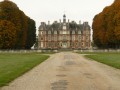
Ecomuseum, Notre-Dame du Chêne Chapel and Houssoy Castle in Crouy-sur-Ourcq.
Washing houses.

Always be cautious and plan ahead when you're outdoors. Visorando and the author of this route cannot be held responsible for any accidents occurring on this route.

The GR® and PR® markings are the intellectual property of the Fédération Française de Randonnée Pédestre.

Reviews and comments

5 / 5
Based on 2 reviews

Reliability of the description
5 / 5
Ease of following the route
5 / 5
Route interest
5 / 5
Tylec
Tylec

Hello,
I don’t understand your comment. Could you please specify which part you’re referring to?

Machine-translated

Philippe CJ
Philippe CJ

Overall rating : 5 / 5

Date of your route : Jun 23, 2024
Reliability of the description : ★★★★★ Very good
Ease of following the route : ★★★★★ Very good
Route interest : ★★★★★ Very good
Very busy route : No

A superb route through woods, fields, along the canal and past hamlets, offering a lovely variety of landscapes and views.
Just one comment. Towards the end of the route, near the canal, the route avoids the towpath, which increases the proportion of the journey spent on roads.
Thank you very much!

Machine-translated

gecar77
gecar77

Overall rating : 5 / 5

Date of your route : May 26, 2023
Reliability of the description : ★★★★★ Very good
Ease of following the route : ★★★★★ Very good
Route interest : ★★★★★ Very good
Very busy route : No

We went on this very pleasant walk on Thursday, which is perhaps not the best day for active walkers. That explains why we didn’t come across any other walkers.

Machine-translated

Other walks in the area

For more walks, use our search engine .

The GPS track and description are the property of this route's author. Please do not copy them without permission.