Around Laillé

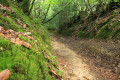
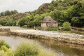
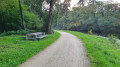
A beautiful walk through meadows and forest with numerous ponds along the way.

Details

505408
Creation:
Last update:
Last review:
  • Walking
    Activity: Walking
  • ↔
    Distance: 7.15 mi
  • ◔
    Average duration: 3h 35 
  • ▲
    Difficulty: Moderate

  • ⚐
    Back to start: Yes
  • ↗
    Ascent: + 371 ft
  • ↘
    Descent: - 390 ft

  • ▲
    Highest point: 348 ft
  • ▼
    Lowest point: 72 ft
  • ⚐ Country: France
  • ⚐ City: Laillé (35890)
  • ⚑
    Start/End: N 47.978107° / W 1.719933°
  • ❏
    IGN map(s): Ref. 1219SB
  • Hour-by-hour weather

Photos

Description of the walk

Park in the church car park.

(S/E) From the church, head west to take Allée du Château Noble and join Rue de l'Hôtel de Ville. Turn left and continue for a few dozen metres.

(1) Follow the path on the right, to the left of the butcher's shop (yellow markings), then turn slightly left at Impasse Yves Montant. Continue straight ahead on this path, which crosses Rue de la Châtaigneraie, then Rue des Nénuphars and finally Impasse des Trois Etangs. Pass the ponds on your left and a poultry farm.

(2) After the poultry farm, leave the path on the right and take the small path opposite (yellow markings).

(3) At the "Arrêté municipal" sign, turn left onto theGR®39(Circuit de la Vallée). Leave the Chemin de la Hyaume on your right and continue straight ahead. When the path widens, continue to the road and turn left, following it for about 50 metres.

(4) Turn right (sign for La Macillais). When you reach a wider path, turn right (orange markings) towards the small wood. After a sharp left turn, walk along a pond on your left and continue along the path until you reach the road.

(5) Follow the road to the left and then cross the hamlet of La Macillais.

(6) Once you reach the D77, cross the road and continue along the path opposite. After 100 metres, do not turn left towards Les Clôtures but continue along the path that climbs into the forest. N.B. On this part of the circuit, we are walking alongside a section of private forest: a barbed wire fence and signs every 50 metres indicate that access is prohibited. Continue straight ahead until you reach a carriage road, leaving the first path on your left.

(7) Turn left onto the carriage road. On your right is the bell tower of Bourg-des-Comptes. Pass the first path on the right and when you reach the houses of La Gautrais, pass the path on the right and continue straight ahead (orange markings). Pass the first path on the right and continue on the path, which narrows.

(8) Follow a very sharp left turn (signposted Circuit de la Chapelle) and continue straight ahead between two rows of fences, so there is no risk of going wrong.

(9) Continue straight ahead on the Circuit de la Chapelle. You will come to a pretty stone house, which you should go around on the right at a place called Le Haut Gourdel. At the junction with the small road, continue straight ahead and then leave a path on the left near a stone house. Continue downhill to a small road.

(10) Take the road on the left and, just after the pond on the left, take the path on the right (yellow markings). Follow the Ruisseau du Désert stream and continue along the path on the left (orange markings) which climbs up to the Route de la Roche.

(11) Turn left, then after 100 metres, just before the Chapelle du Désert (picnic tables), turn onto the path going up to the right (yellow markings).

(12) Before the hamlet of La Gaudinais (large green shed on the right), take the path on the left (yellow markings). Continue to La Reculais and go straight on along the small path to the right of the calvary. The path continues with a right-hand bend followed immediately by a left-hand bend. Continue straight on until you reach the road.

Turn left towards Petite Forêt, then at the first crossroads, take the path on the right between the houses. Continue straight ahead to Rue de Mandon and turn right onto this street until you reach Rue du Point du Jour. Turn left to return to the starting point near the church (S/E).

Waypoints

  1. S/E : mi 0 - alt. 341 ft - Church car park
  2. 1 : mi 0.11 - alt. 344 ft - Path on the right
  3. 2 : mi 0.56 - alt. 292 ft - Poultry farm
  4. 3 : mi 0.84 - alt. 269 ft - GR39
  5. 4 : mi 1.46 - alt. 92 ft - Macillais sign
  6. 5 : mi 2.26 - alt. 184 ft - La Macillais hamlet
  7. 6 : mi 2.53 - alt. 243 ft - Crossing the D77
  8. 7 : mi 2.96 - alt. 322 ft - Carriageway
  9. 8 : mi 3.81 - alt. 322 ft - Start of the barbed wire fence
  10. 9 : mi 4.02 - alt. 338 ft - End of the barbed wire fence
  11. 10 : mi 4.94 - alt. 220 ft - Turn left onto the road
  12. 11 : mi 5.45 - alt. 266 ft - La Roche
  13. 12 : mi 5.92 - alt. 348 ft - Hamlet of La Gaudinais
  14. S/E : mi 7.15 - alt. 341 ft - Church car park

Notes

(11) Close to the chapel, there is a picnic table where you can take a break.

Always be cautious and plan ahead when you're outdoors. Visorando and the author of this route cannot be held responsible for any accidents occurring on this route.

The GR® and PR® markings are the intellectual property of the Fédération Française de Randonnée Pédestre.

Reviews and comments

4.7 / 5
Based on 22 reviews

Reliability of the description
4.7 / 5
Ease of following the route
4.8 / 5
Route interest
4.6 / 5
CASEON35
CASEON35

Overall rating : 4.7 / 5

Date of your route : Mar 02, 2026
Reliability of the description : ★★★★★ Very good
Ease of following the route : ★★★★★ Very good
Route interest : ★★★★☆ Good
Very busy route : No

A beautiful hike. Laillé is well located and has retained its authenticity with its paths within and outside the municipality.
The route covers a good distance (11.5 km) and passes through the village, the countryside and the surrounding forest.
Almost the entire hike is on dirt paths, which makes it very pleasant (except during the winter when it is very rainy). The elevation gain is nice.
Only the "Tir à bal" posters can be a bit unsettling, but they seem to be there mainly to scare people. If you follow the route and the path, I don't think there is any risk.
In short, it's a beautiful route that I will do again, either alone or with my family
I think there are several variations available to increase or decrease the distance.

Machine-translated

demay
demay

Overall rating : 4.7 / 5

Date of your route : Mar 02, 2026
Reliability of the description : ★★★★★ Very good
Ease of following the route : ★★★★★ Very good
Route interest : ★★★★☆ Good
Very busy route : Yes

A very beautiful hike despite the paths being a bit muddy given the season.

Machine-translated

legaud eric
legaud eric

Overall rating : 5 / 5

Date of your route : Oct 07, 2024
Reliability of the description : ★★★★★ Very good
Ease of following the route : ★★★★★ Very good
Route interest : ★★★★★ Very good
Very busy route : No

Nice wooded trail, but stay alert as there are quite a few mountain bikes around too.

Machine-translated

AJP
AJP

Overall rating : 4 / 5

Date of your route : Jun 30, 2024
Reliability of the description : ★★★★☆ Good
Ease of following the route : ★★★★☆ Good
Route interest : ★★★★☆ Good
Very busy route : Yes

Very, very beautiful. But beware: 80% of it is a mountain bike trail. I had the misfortune of setting off on the day of a group mountain bike ride (without knowing, of course). This meant that I was overtaken by a mountain bike about 200 times, often on narrow paths. Absolutely hellish. Try to check before you go.

Machine-translated

MireillePacheu
MireillePacheu

Overall rating : 5 / 5

Date of your route : Aug 28, 2023
Reliability of the description : ★★★★★ Very good
Ease of following the route : ★★★★★ Very good
Route interest : ★★★★★ Very good
Very busy route : No

A very pleasant hike, often through wooded areas on roads suitable for vehicles. A nice distance for a Sunday morning.

Machine-translated

Breizh35
Breizh35

Overall rating : 4.7 / 5

Date of your route : May 15, 2023
Reliability of the description : ★★★★★ Very good
Ease of following the route : ★★★★★ Very good
Route interest : ★★★★☆ Good
Very busy route : No

A very easy and pleasant walk through woodland and countryside
The signposting is excellent, impossible to get lost
I imagine it's very pleasant in summer with dry paths and the forest providing shade
Walk takes 2 hours 50 minutes without running

Thank you for the walk

Machine-translated

ysbdd
ysbdd

Overall rating : 5 / 5

Date of your route : Nov 29, 2021
Reliability of the description : ★★★★★ Very good
Ease of following the route : ★★★★★ Very good
Route interest : ★★★★★ Very good
Very busy route : No

Very interesting route
Varied landscapes, beautiful trails
Perfect route
Not even spoiled by the numerous alarming signs put up by an unwelcoming forest owner.

Machine-translated

Landrea
Landrea

Overall rating : 4.3 / 5

Date of your route : Nov 14, 2021
Reliability of the description : ★★★★☆ Good
Ease of following the route : ★★★★☆ Good
Route interest : ★★★★★ Very good
Very busy route : No

A very pleasant and varied route. Lost the markings between points 4 and 5. Perhaps a marker should be added or, unless I am mistaken, a sign indicating to turn right when leaving the path that joins a larger path at a T-junction, before the "sharp left turn" and the pond. My memory is not clear, I would need to do it again.

Machine-translated

Mona Alice
Mona Alice

Overall rating : 5 / 5

Date of your route : May 03, 2021
Reliability of the description : ★★★★★ Very good
Ease of following the route : ★★★★★ Very good
Route interest : ★★★★★ Very good
Very busy route : Yes

A very beautiful hike without much difficulty, alternating between trails and paths. Very little tarmac.

Pleasant forest path, only downside: lined with posts and barbed wire, we cross private property, littered with signs "warning" us not to leave the path with "live ammunition", a little too much for our liking...

The signposting is adequate, but it's best to have the map, as it's possible to take a wrong turn two or three times.

Recommended, especially in spring.

Machine-translated

CélineG
CélineG

Overall rating : 5 / 5

Date of your route : Jul 06, 2020
Reliability of the description : ★★★★★ Very good
Ease of following the route : ★★★★★ Very good
Route interest : ★★★★★ Very good
Very busy route : No

A very beautiful hike, mostly shaded... perfect when it's hot. We recommend it and will happily do it again.

Machine-translated

DODOMIQUE
DODOMIQUE

Overall rating : 4.7 / 5

Date of your route : Jun 23, 2020
Reliability of the description : ★★★★★ Very good
Ease of following the route : ★★★★☆ Good
Route interest : ★★★★★ Very good
Very busy route : No

Very beautiful route, mainly on trails
Beautiful views over the Vilaine valley
Easy to follow, with only one slightly wet section
I recommend it

Machine-translated

dela.mae
dela.mae

Overall rating : 5 / 5

Date of your route : May 28, 2020
Reliability of the description : ★★★★★ Very good
Ease of following the route : ★★★★★ Very good
Route interest : ★★★★★ Very good
Very busy route : No

A superb shaded circuit with very clear explanations that reassure you throughout the route. I highly recommend it!!

Machine-translated

Clarkemarche
Clarkemarche

Overall rating : 4.3 / 5

Date of your route : May 17, 2020
Reliability of the description : ★★★★☆ Good
Ease of following the route : ★★★★☆ Good
Route interest : ★★★★★ Very good
Very busy route : Yes

Thank you for this itinerary. I had already done it once 4-5 years ago, so I found the description useful; it's not very well signposted by the local council. I also consulted the map during the trip. We took a wrong turn once, near the Haut Gourdel farm, mainly because of the terrain.
It's a very beautiful, diverse valley, and the weather was perfect for hiking. We came across other people (unusual for this time of year...) and for a Sunday, it wasn't overly crowded.

Machine-translated

Egres35
Egres35

Overall rating : 5 / 5

Date of your route : Feb 22, 2020
Reliability of the description : ★★★★★ Very good
Ease of following the route : ★★★★★ Very good
Route interest : ★★★★★ Very good

Very good description of the route, I followed the directions without really looking at the map. Just at the end of the "Petite Forêt" path, I didn't see the sign indicating it, so: "turn left when you see the houses of a housing estate" and after the path between the houses "cross the first street and continue straight ahead..." (the street names are not indicated on the map).
There are many very wet areas (almost impassable), but alone or with two or three people it's fine, and you can walk along either a field or through the forest (away from the "shooting ranges").
A very slight detour to see the chapel (closed), but I took the opportunity to have a picnic on the table.
To be done again in the sunshine.
Thank you for this route.

Machine-translated

tugny44
tugny44

Overall rating : 4.7 / 5

Date of your route : May 14, 2019
Reliability of the description : ★★★★★ Very good
Ease of following the route : ★★★★★ Very good
Route interest : ★★★★☆ Good

A very pleasant trail, especially because there is very little walking on tarmac. A hilly trail offering distant views. A very shady trail, which we appreciated on this beautiful sunny day.
The description is very precise, making it easy to find the right trail.
No particular difficulties, it's the kind of route we really enjoy.
We recommend it.

Machine-translated

Other walks in the area

For more walks, use our search engine .

The GPS track and description are the property of this route's author. Please do not copy them without permission.