


Shropshire Hills 12 Hills
Details
Creation:
Last update:
–
–
-
 Activity: Walking
 -
 Distance: 36.99 mi
 -
 Average duration: 23h 50
 -
 Difficulty: Not specified
 -
-
 Back to start: Yes
 -
 Ascent: + 7,864 ft
 -
 Descent: - 7,867 ft
 -
-
 Highest point: 1,729 ft
 -
 Lowest point: 561 ft
-
 Country:
United Kingdom
Country:
United Kingdom
-
 City:
Church Stretton
City:
Church Stretton -
 Start/End: N 52.536692° / W 2.805525°
 -


 Hour-by-hour weather


Waypoints
- S/E : mi 0 - alt. 610 ft - Start on Central Avenue
- 1 : mi 0.01 - alt. 610 ft - Turn right onto Coffin Lane or The Narrows
- 2 : mi 0.13 - alt. 633 ft - Turn right onto High Street, B5477
- 3 : mi 0.16 - alt. 633 ft - Turn left
- 4 : mi 0.17 - alt. 640 ft - Keep right
- 5 : mi 0.19 - alt. 643 ft - Turn slight left
- 6 : mi 0.21 - alt. 643 ft - Turn slight right
- 7 : mi 0.23 - alt. 646 ft - Turn left onto Churchway
- 8 : mi 0.28 - alt. 656 ft - Keep left
- 9 : mi 0.45 - alt. 774 ft - Turn sharp right
- 10 : mi 0.47 - alt. 781 ft - Turn sharp right onto Cunnery Road
- 11 : mi 0.5 - alt. 771 ft - Keep left onto Cunnery Road
- 12 : mi 0.56 - alt. 758 ft - Turn right
- 13 : mi 0.67 - alt. 902 ft - Turn right
- 14 : mi 0.71 - alt. 965 ft - Turn left
- 15 : mi 1.16 - alt. 1,345 ft - Turn slight right
- 16 : mi 1.2 - alt. 1,358 ft - Keep left
- 17 : mi 1.52 - alt. 1,417 ft - Turn slight left
- 18 : mi 1.57 - alt. 1,365 ft - Keep left
- 19 : mi 2.02 - alt. 1,490 ft - Keep left
- 20 : mi 2.51 - alt. 1,575 ft - Keep left
- 21 : mi 2.64 - alt. 1,558 ft - Turn slight left onto The Portway
- 22 : mi 2.99 - alt. 1,608 ft - Turn right
- 23 : mi 3.17 - alt. 1,690 ft - Turn right
- 24 : mi 3.34 - alt. 1,647 ft - Turn sharp left
- 25 : mi 4.46 - alt. 1,073 ft - Keep right
- 26 : mi 5.26 - alt. 1,079 ft - Turn slight left
- 27 : mi 5.3 - alt. 1,070 ft - Turn left
- 28 : mi 5.52 - alt. 1,165 ft - Turn right
- 29 : mi 5.53 - alt. 1,161 ft - Keep left
- 30 : mi 6.03 - alt. 827 ft - Turn slight right
- 31 : mi 6.04 - alt. 830 ft - Turn left
- 32 : mi 6.05 - alt. 830 ft - Turn left
- 33 : mi 6.1 - alt. 850 ft - Keep right
- 34 : mi 6.86 - alt. 978 ft - Keep left
- 35 : mi 7.5 - alt. 1,115 ft - Turn left
- 36 : mi 7.92 - alt. 948 ft - Turn right
- 37 : mi 8.2 - alt. 991 ft - Turn right
- 38 : mi 8.62 - alt. 1,319 ft - Keep left
- 39 : mi 8.68 - alt. 1,306 ft - Turn left
- 40 : mi 9.1 - alt. 1,145 ft - Keep right
- 41 : mi 9.13 - alt. 1,142 ft - Keep left
- 42 : mi 9.42 - alt. 1,286 ft - Keep left
- 43 : mi 9.55 - alt. 1,286 ft - Turn left
- 44 : mi 9.7 - alt. 1,099 ft - Turn right
- 45 : mi 10.11 - alt. 1,145 ft - Turn slight left
- 46 : mi 10.53 - alt. 1,306 ft - Turn right
- 47 : mi 10.59 - alt. 1,319 ft - Turn sharp left
- 48 : mi 11.64 - alt. 1,434 ft - Turn slight left
- 49 : mi 11.91 - alt. 1,604 ft - Keep right
- 50 : mi 13.04 - alt. 1,591 ft - Turn right
- 51 : mi 13.24 - alt. 1,512 ft - Turn right
- 52 : mi 13.63 - alt. 1,296 ft - Turn right
- 53 : mi 14.59 - alt. 1,388 ft - Keep right
- 54 : mi 14.72 - alt. 1,388 ft - Turn sharp left
- 55 : mi 16.43 - alt. 843 ft - Turn left
- 56 : mi 16.46 - alt. 837 ft - Turn sharp right
- 57 : mi 16.75 - alt. 846 ft - Keep left
- 58 : mi 17.02 - alt. 879 ft - Turn right
- 59 : mi 17.16 - alt. 915 ft - Turn left
- 60 : mi 17.3 - alt. 932 ft - Keep right
- 61 : mi 17.35 - alt. 925 ft - Turn left
- 62 : mi 17.36 - alt. 925 ft - Turn right
- 63 : mi 18 - alt. 1,017 ft - Turn right
- 64 : mi 18.96 - alt. 1,401 ft - Turn right
- 65 : mi 19.58 - alt. 1,506 ft - Turn right
- 66 : mi 19.61 - alt. 1,516 ft - Turn left
- 67 : mi 20.06 - alt. 1,365 ft - Keep right
- 68 : mi 20.64 - alt. 1,096 ft - Keep left
- 69 : mi 20.83 - alt. 1,047 ft - Keep right
- 70 : mi 20.86 - alt. 1,047 ft - Turn slight right onto Plush Hill
- 71 : mi 21.22 - alt. 866 ft - Keep right
- 72 : mi 21.62 - alt. 620 ft - Turn slight left onto Batch Valley
- 73 : mi 21.63 - alt. 617 ft - Turn right
- 74 : mi 21.65 - alt. 614 ft - Keep right
- 75 : mi 21.72 - alt. 656 ft - Turn right
- 76 : mi 21.74 - alt. 666 ft - Keep left
- 77 : mi 21.76 - alt. 689 ft - Turn left
- 78 : mi 21.78 - alt. 722 ft - Turn left
- 79 : mi 22.3 - alt. 741 ft - Turn left onto Cwms Dale
- 80 : mi 22.44 - alt. 682 ft - Turn left
- 81 : mi 22.94 - alt. 617 ft - Turn right
- 82 : mi 23.04 - alt. 597 ft - Turn left onto Shrewsbury Road, B5477
- 83 : mi 23.14 - alt. 587 ft - Turn right
- 84 : mi 23.34 - alt. 568 ft - Turn slight left
- 85 : mi 23.4 - alt. 568 ft - Turn left
- 86 : mi 23.58 - alt. 564 ft - Turn right
- 87 : mi 23.97 - alt. 827 ft - Turn left
- 88 : mi 24.38 - alt. 856 ft - Keep left
- 89 : mi 25.01 - alt. 682 ft - Turn right
- 90 : mi 25.16 - alt. 636 ft - Turn left
- 91 : mi 25.4 - alt. 591 ft - Turn right
- 92 : mi 25.47 - alt. 623 ft - Keep right
- 93 : mi 26.88 - alt. 623 ft - Turn slight left
- 94 : mi 26.95 - alt. 591 ft - Turn left
- 95 : mi 27.08 - alt. 607 ft - Keep right
- 96 : mi 27.19 - alt. 636 ft - Turn slight left
- 97 : mi 27.22 - alt. 636 ft - Turn right
- 98 : mi 27.43 - alt. 889 ft - Keep left
- 99 : mi 28.04 - alt. 1,490 ft - Turn slight left
- 100 : mi 28.18 - alt. 1,411 ft - Turn left
- 101 : mi 28.22 - alt. 1,381 ft - Turn slight left
- 102 : mi 28.26 - alt. 1,345 ft - Turn sharp right
- 103 : mi 28.77 - alt. 1,007 ft - Keep left
- 104 : mi 28.97 - alt. 1,253 ft - Turn right
- 105 : mi 29.45 - alt. 1,322 ft - Keep left
- 106 : mi 29.59 - alt. 1,276 ft - Turn left
- 107 : mi 29.83 - alt. 1,106 ft - Turn right
- 108 : mi 30.01 - alt. 856 ft - Turn left
- 109 : mi 30.09 - alt. 840 ft - Turn left onto Sandford Avenue, B4371
- 110 : mi 30.09 - alt. 840 ft - Turn right onto Henley Lane
- 111 : mi 30.49 - alt. 1,017 ft - Turn right
- 112 : mi 30.88 - alt. 1,017 ft - Turn sharp right onto Henley Lane
- 113 : mi 31.33 - alt. 1,014 ft - Turn right
- 114 : mi 31.47 - alt. 1,112 ft - Keep left
- 115 : mi 32.78 - alt. 594 ft - Turn right
- 116 : mi 32.82 - alt. 587 ft - Turn right onto A49
- 117 : mi 32.89 - alt. 597 ft - Turn left onto Crown Lane
- 118 : mi 32.99 - alt. 600 ft - Turn right onto Ludlow Road, B5477
- 119 : mi 33 - alt. 600 ft - Turn left
- 120 : mi 33.19 - alt. 620 ft - Keep left
- 121 : mi 33.26 - alt. 630 ft - Keep left
- 122 : mi 33.61 - alt. 873 ft - Keep left
- 123 : mi 33.63 - alt. 896 ft - Keep left
- 124 : mi 33.69 - alt. 988 ft - Turn left
- 125 : mi 34.1 - alt. 1,217 ft - Turn right
- 126 : mi 34.11 - alt. 1,204 ft - Turn sharp left
- 127 : mi 35.06 - alt. 692 ft - Turn right
- 128 : mi 35.35 - alt. 643 ft - Keep left
- 129 : mi 35.43 - alt. 630 ft - Turn left
- 130 : mi 35.44 - alt. 630 ft - Turn left
- 131 : mi 36.16 - alt. 607 ft - Turn left onto Ludlow Road, B5477
- 132 : mi 36.83 - alt. 627 ft - Turn right
- 133 : mi 36.87 - alt. 623 ft - Turn left onto Central Avenue
- 134 : mi 36.91 - alt. 617 ft - Turn left onto Central Avenue
- 135 : mi 36.93 - alt. 620 ft - Turn right onto Coffin Lane or The Narrows
- 136 : mi 36.98 - alt. 610 ft - Turn left onto Central Avenue
- S/E : mi 36.99 - alt. 610 ft
Other walks in the area
The Long Mynd, Church Stretton, Wenlock Edge to Much Wenlock
 Visorando Member18.12 mi
+1,299 ft
-2,349 ft
9h 30
Visorando Member18.12 mi
+1,299 ft
-2,349 ft
9h 30
 Difficult
 Departure from Ratlinghope (Shropshire)
A long walk, but mainly downhill. Beautiful & with old railway interest on Wenlock Edge around Presthope. Largely following the Jack Mytton way. Reduce the climbing by taking the east option just south of Church Stretton.
The Stiperstones and Blakemoor Flat from the Knolls
4.82 mi
+663 ft
-525 ft
2h 50
 Easy
Departure from Ratlinghope (Shropshire)
Easy
Departure from Ratlinghope (Shropshire)
A short walk in the Shropshire Hills that provides some wonderful views. The Stiperstones have a rocky quartzite ridge and this provides a dramatic backdrop to the walk.
The Hollies & Poles Coppice from near Habberley
4.50 mi
+581 ft
-594 ft
2h 35
Easy
Departure from Pontesbury (Shropshire)
This Shropshire walk explores the countryside to the north of the Stiperstones. The route is generally on well marked paths and tracks. One of the highlights of the walk is the area known as the Hollies which is home to some of the oldest Holly trees in the UK, with some dating back over 400 years.
The Wrekin from near Cluddley
2.35 mi
+719 ft
-568 ft
1h 40
Easy
Departure from Little Wenlock (Telford and Wrekin)
This Shropshire walk takes the direct approach to the summit of the Wrekin near Telford. The views are good especially on clear days and it makes a perfect half day walk.
A Wrekin circuit from near Cluddley
4.27 mi
+1,102 ft
-1,047 ft
2h 55
Easy
Departure from Little Wenlock (Telford and Wrekin)
An ascent of the Wrekin, near Telford, makes an excellent half day walk. This route offers good views over the Shropshire countryside. It must be noted that there are two short but steep sections of ascent onto the main ridge but the views are outstanding on a clear day and worth the effort.
Offa’s Dyke No3 (Monument)
4.16 mi
+436 ft
-456 ft
2h 20
 Moderate
Departure from Powys
Moderate
Departure from Powys
A little easy walk taking in some of Offa’s Dyke path mid Wales and some beautiful scenery.
Such an unspoilt walk / area with the entire walk.
Wildlife included Red Kites which were flying very close to us, a selection of Eurasian birds, rabbits & the usual sheep which we see a lot of in this area.
The route is very well sign posted over the hills…
This walk is rated moderate as there are some hilly sections that can be difficult for some people.
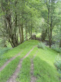
Wales to England & back again!
 10.05 mi
+971 ft
-965 ft
5h 30
Moderate
Departure from Presteigne (Powys)
10.05 mi
+971 ft
-965 ft
5h 30
Moderate
Departure from Presteigne (Powys)
A nice testing walk up some steep hills... starting as you walk north out of Presteigne on a road that the border runs along climbing up to see some fantastic panoramic views at The Warren. Once you leave the road, the ground is a bit lumpy heading east for a short distance before heading down towards The Globe woods which are a delightful view with rolling countryside.
The path is well marked but with not much traffic, the flora is quite wild with bracken 6ft tall in places...
Head down towards the Stapleton ruins which are not accessible to the public but a beautiful view from a distance
Presteigne Loop
 4.10 mi
+167 ft
-167 ft
2h 00
Easy
Departure from Presteigne (Powys)
4.10 mi
+167 ft
-167 ft
2h 00
Easy
Departure from Presteigne (Powys)
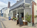
A delightful easy walk around the historic town of Presteigne taking in some beautiful countryside getting very close to the local sheep / cows and we saw a couple of rabbits along the way.
Part of the route follows the River Lugg (Powys) in which you can stand on a bridge with one foot in England & one foot in Wales!
For more walks, use our search engine .
The GPS track and description are the property of this route's author. Please do not copy them without permission.

