


Merriott Short Circular
Details
Creation:
Last update:
–
–
-
 Activity: Walking
 -
 Distance: 2.50 mi
 -
 Average duration: 1h 15
 -
 Difficulty: Not specified
 -
-
 Back to start: Yes
 -
 Ascent: + 72 ft
 -
 Descent: - 72 ft
 -
-
 Highest point: 197 ft
 -
 Lowest point: 95 ft
-
 Country:
United Kingdom
Country:
United Kingdom
-
 City:
Merriott
City:
Merriott -
 Start/End: N 50.913996° / W 2.789292°
 -


 Hour-by-hour weather


Waypoints
- S/E : mi 0 - alt. 167 ft - Start on
- 1 : mi 0.01 - alt. 167 ft - Turn right onto Higher Street
- 2 : mi 0.04 - alt. 167 ft - Turn left onto Townsend Orchard
- 3 : mi 0.06 - alt. 167 ft - Turn slight left
- 4 : mi 0.33 - alt. 128 ft - Turn right
- 5 : mi 0.58 - alt. 144 ft - Turn right onto Boozer Pit
- 6 : mi 0.65 - alt. 141 ft - Turn left onto Monkhouse Lane
- 7 : mi 0.76 - alt. 151 ft - Turn left
- 8 : mi 1.01 - alt. 95 ft - Turn sharp right
- 9 : mi 1.37 - alt. 102 ft - Turn right
- 10 : mi 1.66 - alt. 118 ft - Turn right
- 11 : mi 1.66 - alt. 118 ft - Turn right onto Lower Street
- 12 : mi 1.67 - alt. 121 ft - Turn left
- 13 : mi 1.95 - alt. 171 ft - Turn right onto Evergreen Path
- 14 : mi 2.03 - alt. 184 ft - Turn right onto Church Street
- 15 : mi 2.04 - alt. 180 ft - Turn left onto Sandy Hole
- 16 : mi 2.13 - alt. 194 ft - Turn right
- 17 : mi 2.4 - alt. 174 ft - Turn right
- 18 : mi 2.45 - alt. 167 ft - Turn slight right onto Townsend Orchard
- 19 : mi 2.46 - alt. 167 ft - Turn right onto Higher Street
- S/E : mi 2.5 - alt. 167 ft
Other walks in the area
Bishopswood Meadows (and Jan Hobbs) Nature Reserve
 Visorando Member2.24 mi
+279 ft
-249 ft
1h 15
Visorando Member2.24 mi
+279 ft
-249 ft
1h 15
 Easy
Easy
 Departure from Otterford (Somerset)
Species-rich limestone and marshy meadows beside River Yarty.
Dundon Beacon Nature Reserve, Compton Dundon
2.42 mi
+315 ft
-305 ft
1h 25
Easy
Departure from Compton Dundon (Somerset)
A mosaic of calcareous grassland, scrub, ancient oak woodland, secondary woodland and conifer plantation on Dundon Hill. The top of Dundon Hill features significant archaeological remains with a hill fort, Bronze Age round barrow and ancient quarry.
A challenging day-long hike taking in the beauty of West Dorset.
20.24 mi
+1,893 ft
-1,893 ft
8 hrs
 Extremely difficult
Departure from Chideock (Dorset)
Extremely difficult
Departure from Chideock (Dorset)
If you want beaches, cliffs, woodlands and meadows and a walk that will test your fitness, this is the one for you.
White Field Nature Reserve, Butleigh
2.11 mi
+62 ft
-62 ft
1h 00
Easy
Departure from Butleigh (Somerset)
Unimproved neutral grassland and a small copse. The site has open access via rights of way from Butleigh. Please keep to the edges of the field until the hay has been cut.
Seatown from Charmouth via Golden Cap
3.93 mi
+925 ft
-902 ft
2h 35
Easy
Departure from Charmouth (Dorset)
This linear Dorset walk follows the South West Coast Path from Charmouth to Seatown. The coastal scenery on this part of the Jurassic Coast is dramatic and the walk includes the highest point on the Dorest Coast at Golden Cap.
South Cadbury, Somerset
 9.04 mi
+719 ft
-722 ft
4h 45
9.04 mi
+719 ft
-722 ft
4h 45
 Moderate
Departure from South Cadbury and Sutton Montis (Somerset)
Moderate
Departure from South Cadbury and Sutton Montis (Somerset)
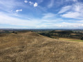
The walk follows the Corton Ridge and offers great views across the Somerset Levels and the Dorset Hills. It has great historic significance as Cadbury Castle is reputed to be Camelot King Arthur's Castle. You also cross the ancient medieval village of Whitcombe. It's an up and downer and can be boggy in wet weather. As an incentive there are two great pubs you can call in at!
Blackbrook Meander
1.76 mi
+16 ft
-16 ft
0h 50
Easy
Departure from Taunton (Somerset)
A gentle meander alongside Blackbrook and around pleasant Hamilton Gault Park. The stream is a traffic-free route for wildlife in and out of the town, including otters and water voles. Come out on a summer evening and watch bats flying above your head catching insects.
For more walks, use our search engine .
The GPS track and description are the property of this route's author. Please do not copy them without permission.

