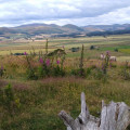
Berwick To Lindisfarne
Technical sheet
Creation:
Last update:
–
–
-
 Activity: Walking
 -
Distance: 23.16 km
-
Average duration: 6h 45
-
Difficulty: Not specified
-
-
Return to departure point: No
-
Vertical gain: + 32 m
-
Vertical drop: - 55 m
-
-
Highest point: 37 m
-
Lowest point: 1 m
-
Country: United Kingdom
-
District: Berwick-upon-Tweed
-
Start: N 55.774451° / W 2.010244°
-
End: N 55.671243° / W 1.800557°
Waypoints
- S : km 0 - alt. 34 m - Start on
- 2 : km 0.01 - alt. 34 m - At roundabout, take exit 2
- 3 : km 0.13 - alt. 37 m - Turn right onto Railway Street
- 4 : km 0.14 - alt. 37 m - Turn sharp right
- 5 : km 0.21 - alt. 31 m - Turn left
- 6 : km 0.22 - alt. 31 m - Keep left
- 7 : km 0.28 - alt. 23 m - Turn right
- 8 : km 0.36 - alt. 5 m - Turn left
- 9 : km 0.76 - alt. 10 m - Keep right
- 10 : km 0.89 - alt. 7 m - Turn left onto Bridge Terrace
- 11 : km 0.95 - alt. 4 m - Turn left onto Bridge End
- 12 : km 1.3 - alt. 4 m - Turn right onto Union Brae
- 13 : km 1.31 - alt. 4 m - Turn sharp right onto Main Street
- 14 : km 1.5 - alt. 5 m - Keep right onto Main Street
- 15 : km 1.6 - alt. 10 m - Turn left onto Brewery Lane
- 16 : km 1.7 - alt. 7 m - Turn right onto Church Road
- 17 : km 1.77 - alt. 8 m - Turn left onto Well Square
- 18 : km 1.82 - alt. 8 m - Turn left onto Lees Lane
- 19 : km 1.91 - alt. 8 m - Turn sharp left onto Well Square
- 20 : km 2.14 - alt. 5 m - Turn right onto Dock Road
- 21 : km 2.81 - alt. 5 m - Turn sharp right onto Princes Street
- 22 : km 4.51 - alt. 5 m - Turn sharp left
- 23 : km 4.67 - alt. 25 m - Turn sharp left
- 24 : km 6.48 - alt. 23 m - Turn left
- 25 : km 8.16 - alt. 16 m - Keep right
- 26 : km 8.26 - alt. 16 m - Turn slight left
- 27 : km 9.64 - alt. 11 m - Turn sharp left
- 28 : km 9.64 - alt. 11 m - Turn left
- 29 : km 10.63 - alt. 8 m - Turn left
- 30 : km 11.14 - alt. 4 m - Turn right
- 31 : km 11.3 - alt. 4 m - Keep right
- 32 : km 12.65 - alt. 3 m - Keep left
- 33 : km 13.3 - alt. 4 m - Keep left
- 34 : km 13.32 - alt. 4 m - Turn sharp left
- 35 : km 15.89 - alt. 3 m - Turn right
- 36 : km 15.9 - alt. 3 m - Turn right
- 37 : km 16.62 - alt. 4 m - Turn left
- 38 : km 17.4 - alt. 3 m - Turn right
- 39 : km 17.43 - alt. 3 m - Turn right onto Holy Island Road
- 40 : km 22.59 - alt. 8 m - Turn left
- 41 : km 22.64 - alt. 7 m - Turn right
- 42 : km 22.73 - alt. 9 m - Turn right
- 43 : km 22.78 - alt. 10 m - Turn left
- 44 : km 22.79 - alt. 11 m - Turn left onto Chare Ends
- 45 : km 23.13 - alt. 11 m - Turn left onto Front Street
- E : km 23.16 - alt. 10 m
Other walks in the area
 St Abbs Head
Circular walk to St Abbs Head. Great views of the cliffs and the lighthouse.
 A circuit of Holy Island including Lindisfarne Castle

This Northumberland walk makes an anti-clockwise circuit of Holy Island. The route includes Lindisfarne Castle and some wild coastal walking.
Holy Island, off the Northumberland coast, has many historic connections and sees many tourists. However, once away from the village and Lindisfarne Castle you will enjoy some wild coastal scenery in relative solitude.
⚠️The island cannot be reached at high tide so careful advance planning is necessary to complete the walk.
 A circuit of Doddington Moor

A short Northumberland walk that offers some great views south to the Cheviot Hills. Doddington Moor is home to a stone circle and many ancient cup and ring markings on stones spread across the area.
 Black Hag from Kirk Yetholm
This walk in the Northumberland National Park follows the England-Scotland border fence and starts from Kirk Yetholm. The walk uses the Pennine Way to reach Black Hag. The return route follows an alternative route of the Pennine Way back to the start.
For more walks, use our search engine .
The GPS track and description are the property of the author. Do not copy them without permission.


