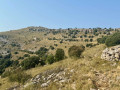
Circular route from the ridges to the sea, starting from Alcossebre

During this walk, you’ll climb up to a chapel at the top of the mountain, reach the highest point of the Itra Nature Reserve, and then descend into a dry riverbed, with abseil ropes in places to help you. You’ll finish by following the rugged coastline past these small coves and beaches .
The best of the region in a single walk.

Details

13398388
Creation:
Last update:
Last review:
  • Walking
    Activity: Walking
  • ↔
    Distance: 12.19 mi
  • ◔
    Average duration: 7h 30 
  • ▲
    Difficulty: Difficult

  • ⚐
    Back to start: No
  • ↗
    Ascent: + 2,139 ft
  • ↘
    Descent: - 2,221 ft

  • ▲
    Highest point: 1,824 ft
  • ▼
    Lowest point: 0 ft

Photos

Description of the walk

The starting point is not far from the supermarket.

(S) Walk up to the start of the footpath towards the Hermitage; it’s just past the Serra d’Itra restaurant on the right.

(1) You arrive at the hermitage – quite a steep climb, mind you.
I imagine that, like me, you’ve made a point of not using the posts and ropes along the way.

(2) Carry on towards the road and turn left immediately after the car park.
Once on the path, we don’t head down towards Santa Benet on the left but follow the path that goes uphill.

(3) You’ll come to a track suitable for vehicles; keep left.
You’ll come to the Ebri tower, clearly visible on the left, and a sign indicates that you can reach it via a small path on the left.

(4) After this short detour, carry on along the track.

(5) A sign points to Campanilles on the left; follow it.

(6) Keep heading towards Campanilles straight ahead.

(7) You reach the summit; take a moment to enjoy the view, then carry on.

(8) You’ll come across another sign; this is where the descent begins, so turn right towards Alcossebre (a warning states that this can be dangerous in the event of flooding)

(9) You reach the track; turn right onto it and follow it for 500 metres

(10) We head down to the left towards the sea and the clearly visible residential complex

(11) Cross the car park of the residential complex, go round the buildings as close to the coast as possible, then follow the coastline. The path is well signposted towards Alcossebre.

(12) You’ll reach the lighthouse and its beach. Climb up the embankment to continue along the coast. From here, you’ll leave the nature reserve and head towards Alcossebre harbour. You’ll arrive at the harbour (E).


Waypoints

  1. S : mi 0 - alt. 92 ft - Next to the supermarket
  2. 1 : mi 0.29 - alt. 190 ft - The Serra d’Itra restaurant
  3. 2 : mi 1.15 - alt. 984 ft - Hermitage
  4. 3 : mi 1.81 - alt. 1,181 ft - Road suitable for vehicles
  5. 4 : mi 2.79 - alt. 1,565 ft - Tour d’Ebri
  6. 5 : mi 3.2 - alt. 1,565 ft - Signpost
  7. 6 : mi 3.52 - alt. 1,516 ft - Signpost
  8. 7 : mi 5.27 - alt. 1,814 ft - Summit - Sommet parc naturel d'Itra
  9. 8 : mi 5.45 - alt. 1,726 ft - Start of the descent
  10. 9 : mi 8.42 - alt. 115 ft - End of the descent
  11. 10 : mi 8.77 - alt. 167 ft - Towards the seaside residence
  12. 11 : mi 9.27 - alt. 10 ft - Seaside accommodation
  13. 12 : mi 10.78 - alt. 10 ft - Itra Lighthouse
  14. E : mi 12.19 - alt. 10 ft - Port d’Alcossebre

Notes

The climb to the hermitage of Sant Benet i Santa Llúcia is steep and gains altitude quickly.
Carry on to the Erbi tower; please note that climbing the tower is dangerous.
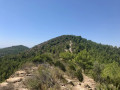
Carry on along the ridge to the highest point, Campanilles, which offers a magnificent panoramic view.
Then there is a dramatic descent through the forest down to the sea, with sections featuring abseil ropes.
We return to Alcossebre via the seafront and its small coves.
This 20 km hike is quite challenging and is suitable for fit walkers.
There are no water sources along the route, so make sure you bring enough water.
Please be aware that in wet weather, the descent to the sea is steep and can be dangerous.
In some places there is no mobile phone signal, particularly during the descent to the sea.

Worth a visit

Magnificent, panoramic views of the sea and the mountains as far as Campanilles
(4) If you’d like to climb the Ebri tower, it’s possible but perilous. There’s a ladder with about 10 rungs, but the very last one is missing, so reaching the top safely is possible but requires caution.
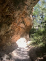
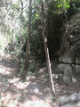
(8) The descent into the steep-sided riverbed is well worth it; you’re isolated in the forest and, at times, in a sort of canyon – it feels as though you’re completely cut off from civilisation
Along the coast between (11) and (12) there are a few small coves and pebble beaches; this can make for a refreshing stop at the end of the walk.

Reviews and comments

5 / 5
Based on 2 reviews

Reliability of the description
5 / 5
Ease of following the route
5 / 5
Route interest
5 / 5
JCParavy
JCParavy

Overall rating : 5 / 5

Date of your route : Aug 22, 2023
Reliability of the description : ★★★★★ Very good
Ease of following the route : ★★★★★ Very good
Route interest : ★★★★★ Very good
Very busy route : No

I’d spotted the possible ridge route across the Serra d’Irta from the Santa Lucia sanctuary, which is clearly visible in the area. This guide describes it in detail, with a return route along the coast.
It’s a long and gruelling route in hot weather. Ideally, you’d need two cars to avoid the return journey along the coast.
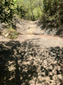
The climb up to Santa Lucia is steep and exposed to the east, so it’s best to set off as early as possible in the morning. The section onwards via the Torre d’Ebrí is easy, but the track is not shaded. The final stretch towards Campanillès is quite long as there are several secondary summits to climb; fortunately, a few pine forests add some charm to the route.
The descent via the Barranc de la Font de la Plana is as wild as you could wish for: a mix of paths, steeper sections and slabs smoothed by the water, some of which are fitted with a rope. There are no particular difficulties, but the atmosphere in the canyon bed is at times reminiscent of an unspoilt forest. It does, however, feel rather endless.
The intense heat and accumulated fatigue made me decide to return to the starting point by car.
In summary, a very interesting circular loop, but best tackled outside the hot season. Don’t underestimate its length.
Footfall: heavy at the Sanctuary, lighter up to the Torre d’Ebrí (mountain biking), and very quiet beyond that.
I’ve attached a few photos.
Jicépé.

Machine-translated

.franck
.franck

Overall rating : 5 / 5

Date of your route : Sep 29, 2021
Reliability of the description : ★★★★★ Very good
Ease of following the route : ★★★★★ Very good
Route interest : ★★★★★ Very good
Very busy route : No

Machine-translated

For more walks, use our search engine .

The GPS track and description are the property of this route's author. Please do not copy them without permission.