Bastei circular walk with the Schwedenlöcher

A lovely circular walk to the famous Bastei in Saxon Switzerland, including the descent through the fascinating Schwedenlöcher.

Details

20759163
Creation:
Last update:
Last review:
  • Walking
    Activity: Walking
  • ↔
    Distance: 3.79 mi
  • ◔
    Average duration: 2h 45 
  • ▲
    Difficulty: Moderate

  • ⚐
    Back to start: Yes
  • ↗
    Ascent: + 1,161 ft
  • ↘
    Descent: - 1,135 ft

  • ▲
    Highest point: 1,053 ft
  • ▼
    Lowest point: 374 ft

Photos

Description of the walk

(Start) The walk begins at the ferry jetty in Rathen. We walk along the Grünbach through the village and turn left into the Amselgrund. Shortly afterwards, the footpath to the Bastei branches off to the left. The path winds its way uphill through the forest, past rocks. To the left, a short detour leads to the viewpoint on the Tiedgestein.

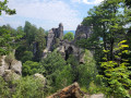
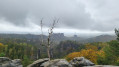
(1) At the Tiedgestein, we enjoy the view of the River Elbe. The ferry jetty where we started is also visible. The footpath then winds its way up steps between tall rocks. This is followed by a second viewpoint overlooking the River Elbe (detour to the left). We then pass the Neurathen rock castle and walk through the impressive Neurathen Rock Gate.

(2) We’ve reached the famous Bastei Bridge. At the end of the bridge, it’s worth taking a detour to the right to the Ferdinandstein (3), from where you’ll have a magnificent view of the Bastei Bridge and Neurathen Rock Castle. Back on the footpath, we pass the panoramic restaurant and the Berghotel Bastei. Just beyond that, on the right, there’s another viewpoint. We then follow the footpath parallel to the road, past the car park and into the forest. At Gansweg, we turn right towards the Schwedenlöcher.

(4) Before the descent through the Schwedenlöcher begins on the left, you have the option of taking a detour to the right to another viewpoint (Pavillonaussicht), which, however, isn’t quite as spectacular as the viewpoints around the Bastei Bridge. The descent through the Schwedenlöcher is partly via stairs and steps and takes you past interesting rock formations. At the end, a bridge crosses the Grünbach. Here we take another detour and turn left.

(5) We follow the footpath to the small Amselfall waterfall. There is also a rustic hut here, an information point for the Saxon Switzerland National Park. Unfortunately, the building is currently closed. We turn back at the Amselfall and follow the Grünbach towards Rathen. The stream widens and eventually flows into Lake Amsel.

(6) You can hire rowing boats at Amselsee. A wide path takes you back to Rathen at a leisurely pace along the Grünbach. At the end of the Amselgrund path, we turn right and shortly afterwards reach the pier (our destination) again.


Waypoints

  1. S/E : mi 0 - alt. 374 ft - Ferry landing stage in Rathen
  2. 1 : mi 0.6 - alt. 709 ft - Tiedgestein
  3. 2 : mi 0.86 - alt. 797 ft - Bastei Bridge
  4. 3 : mi 0.97 - alt. 860 ft - Ferdinandstein
  5. 4 : mi 1.96 - alt. 1,024 ft - Schwedenlöcher
  6. 5 : mi 2.54 - alt. 748 ft - Amselfall
  7. 6 : mi 3.27 - alt. 509 ft - Boat hire at Amselsee
  8. S/E : mi 3.79 - alt. 374 ft - Ferry landing stage in Rathen

Notes

  • Places to stop for refreshments in Rathen and at the Bastei Panorama Restaurant.
  • The descent through the Schwedenlöcher can be slippery after rain.
  • Alternative to the ferry: There are paid car parks at the Berghotel Bastei, although these are often full in summer.

Worth a visit

Highlights of the walk:

  • Neurathen Rock Castle, admission fee applies
  • Neurathen Rock Gate
  • Bastei Bridge (2)
  • Schwedenlöcher (4)
  • Amselsee lake with boat hire (6)

Reviews and comments

5 / 5
Based on 2 reviews

Reliability of the description
5 / 5
Ease of following the route
5 / 5
Route interest
5 / 5
Kristin von Travelinspired

I'm glad you enjoyed it too.

Machine-translated

User 28812137

Overall rating : 5 / 5

Date of your route : Mar 31, 2026
Reliability of the description : ★★★★★ Very good
Ease of following the route : ★★★★★ Very good
Route interest : ★★★★★ Very good
Very busy route : Yes

My son and I really enjoyed the tour. It was easy and we can highly recommend it.

Machine-translated

Steve Barré
Steve Barré

Overall rating : 5 / 5

Date of your route : Aug 04, 2025
Reliability of the description : ★★★★★ Very good
Ease of following the route : ★★★★★ Very good
Route interest : ★★★★★ Very good
Very busy route : No

It was a rainy day, so it was a fairly solitary hike.
But great.

Machine-translated

For more walks, use our search engine .

The GPS track and description are the property of this route's author. Please do not copy them without permission.