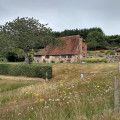
(S/E) Start opposite the Kings Head in Beeding. Walk east along the roadside to the mini roundabout where Hyde Lane heads left. Straight across is a twitten (alleyway) appropriately called The Twitten. Take this to its end.
(1) Up to the lane, take the path to the right of the small recreation ground, turn right up the hill until you see a byway sign with an arrow pointing slightly to the right.
(2) Ignore the arrow and turn left up the chalky path which is signposted from the other side of the byway post. This takes you up to the top of Windmill Hill and back down to the A2037 road, which you cross.
(3) Take the road signposted to the Golding Barn Industrial Estate, which soon becomes a footpath heading uphill.
(4) Take the left path, and you can clearly see the bowl to your left, a deep one with a motocross track at the bottom). The aim is to attain more height, and head round the rim and down the hill beyond this bowl, which takes you to Tottington Manor Farm.
(5) Take the footpath signposted left by the electricity unit, head left and you will walk through pleasant woodland and on to the farm at South Tottington Sands.
(6) Here, you have signposts right and left. Turn left and walk down the track to the A2037 again, crossing it and heading straight on - slightly right of where you cross - on the signposted footpath alongside horse paddocks.
(7) Continue until you see a footbridge on your right and take the path signposted left, which traverses a field and reaches Horton Wood, where you enter via a bridge for a couple of hundred yards before coming out (right) to follow the path down to the riverbank.
(8) Stay on the path alongside the River Adur until you reach a fork by an Environment Agency building. Head south and go through the caravan/mobile home park and you will soon find yourself back on the riverside. heading for the bridge and on your left the start and finish point.(S/E)


