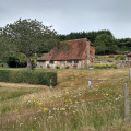
The River Arun & South Stoke from Amberley

Starting from Amberley, this West Sussex Walk explores the River Arun visiting the villages of North and South South Stoke. The return route follows sections of the Monarch's Way and the South Downs Way.

Technical sheet

293030
A Amberley walk posted on 04/07/16 by Walking Britain. Last update : 31/01/23
  • Walking
    Activity: Walking
  • ↔
    Distance: 7.59 km
  • ◔
    Calculated time: 2h 15 
  • ▲
    Difficulty: Easy

  • ⚐
    Return to departure point: Yes
  • ↗
    Vertical gain: + 31 m
  • ↘
    Vertical drop: - 34 m

  • ▲
    Highest point: 23 m
  • ▼
    Lowest point: -2 m

Description

Start : Amberley station (BN18 9LR)

(S/E)Exit Amberley station and walk down to the main road (B2139). Turn left to Houghton Bridge over the River Arun. Half way across the bridge take the footpath on the left. This leads you alongside the River Arun on the east bank of the river. Walk on the riverside for around 600m.

(1)Reaching a footbridge (grid ref TQ021113) cross the dyke and stile, and turn left away from the river. The path leads to Stoke Road (grid ref. TQ024109) (around 500m).

(2) Turn right along the road into the village of North Stoke. Reaching a T-junction turn left to take a path on the right (South) within a few yards.

(3)This path crosses a small suspension bridge continuing to reach the River Arun and a road bridge close to South Stoke (grid ref. TQ026101).

(4) Walk up past St Leonard's church.

(5) Take the bridleway on the right just after South Stoke Farm. This bridleway then follows the west bank of the River all the way back to Houghton for around 2.5 Km. At grid ref. TQ014103 the Monarch's way comes in from the left.

(6) Leave the riverside path and climb into Houghton. Reaching the main road (B2139) through the village.

(7) Turn right and then almost immediately turn left along a lane (Houghton Lane). Follow this North to reach the South Downs Way (SDW) which crosses this lane at grid ref. TQ016118.

(8) Turn right onto the SDW, cross the footbridge over the River Arun and then follow the north bank back to Amberley station.(S/E)

Waypoints

  1. S/E : km 0 - alt. 8 m - Amberley station
  2. 1 : km 0.8 - alt. 0 m - Cross dyke and stile
  3. 2 : km 1.32 - alt. 2 m - Stoke Road - North Stoke
  4. 3 : km 1.61 - alt. 15 m - T-junction
  5. 4 : km 2.74 - alt. 6 m - Road bridge - South Stoke
  6. 5 : km 2.83 - alt. 8 m - St Leonard's church
  7. 6 : km 5.59 - alt. 6 m - Monarch's way - Leave riverside path
  8. 7 : km 5.88 - alt. 17 m - Houghton
  9. 8 : km 6.26 - alt. 7 m - South Downs Way
  10. S/E : km 7.59 - alt. 8 m - Amberley Station

Useful Information

Start : Amberley station (BN18 9LR)

Parking : Amberley station is free parking (but no loo!)

Always stay careful and alert while following a route. Visorando and the author of this walk cannot be held responsible in the event of an accident during this route.

Reviews and comments

4.7 / 5
Based on 10 reviews

Clarity of route description
4.8 / 5
Clarity of route map
4.7 / 5
Walk interest
4.6 / 5
Delphinium
Delphinium

Hi Dante 16,

Thank you for this feedback. I am going to see with the author how to improve the description. Glad you still enjoyed the walk.

Take care

Dante16
Dante16

Overall rating : 4 / 5

Date of walk : 29/01/23
Clarity of route description : ★★★★☆ Good
Clarity of route map : ★★★★☆ Good
Walk interest : ★★★★☆ Good

I did this walk with two friends. We all really liked it overall, but two helpful tips are:
1) There's a word missing on the instructions, quite an important one. Near the end, as you enter Houghton village it says "turn right then immediately turn and carry on etc" The missing word is "immediately turn left".
2) We took a wrong turn. Before getting to Houghton, about two hours in, it says climb up to the main road. We got to some stairs that went up so we took these and went up to the main road but it was so busy we thought we must have gone wrong so we went back down again and carried on up the path and sure enough at the end you climb up a tarmac side road up to the main road. It should have twigged to us because the walk is classed as "easy" an those steps most definitely weren't. So don't make the same mistake as us.
FYI It was very muddy in parts and very narrow in parts, single file walking only. A lovely winters walk over fields and through woods. Amberley station is free parking (but no loo!) and there's a lovely café there where we got some well earned cream teas and coffee afterwards (I had a vegan one which was lovely). It took us 3 1/2 hours including the half hour wrong turn. A great circular walk which we all said we'd like to do again.

Sallybhave
Sallybhave

Overall rating : 5 / 5

Date of walk : 13/05/21
Clarity of route description : ★★★★★ Very good
Clarity of route map : ★★★★★ Very good
Walk interest : ★★★★★ Very good

First time of using this and did get a little confused, but then I can't tell my left from my right!
Parked in the Station Car Park and we had nice weather, felt the dog had to be kept on a lead all the time. Was told that part was flooded so made sure we avoided that and it could be done without wellies.
Very pretty too. The only issue would be the bridge and later on in the year its very busy
Stopped off at the pub on the way back which was so nice to do!
Would happily do again and take more time, visit the museum and also wander round Amberley itself which is very pretty. I understand the cafe is very nice!

mike kitt
mike kitt

Overall rating : 5 / 5

Date of walk : 18/04/21
Clarity of route description : ★★★★★ Very good
Clarity of route map : ★★★★★ Very good
Walk interest : ★★★★★ Very good

Parked up at the carpark just down from Whiteways and adapted the walk from there. lovely warm day and the weather had been fine for a while so easy going ground but it looks like when its been wet it would be muddy and slippery under foot. The walk itself is a good mix of open ground and wooded land with a few houses, farms, and a church thrown in. As I said we adapted the route and on our return found a route up from the river to the road up from Houghton, which was a killer, just think of walking up stairs for 10 minutes and you would be close. Overall a pleasant and well marked out walk.

Jax
Jax

Overall rating : 5 / 5

Date of walk : 02/01/21
Clarity of route description : ★★★★★ Very good
Clarity of route map : N/A
Walk interest : ★★★★★ Very good

Extremely muddy at this time of year but very enjoyable. Will be even better in the Spring/Summer. Thank you

Spanielmum
Spanielmum

Overall rating : 4.7 / 5

Date of walk : 13/11/20
Clarity of route description : ★★★★★ Very good
Clarity of route map : ★★★★☆ Good
Walk interest : ★★★★★ Very good

Good walk, would be better when dry. Great for the dogs, easy to follow directions. Will do again

Cazza
Cazza

Overall rating : 4.7 / 5

Date of walk : 20/07/20
Clarity of route description : ★★★★★ Very good
Clarity of route map : ★★★★★ Very good
Walk interest : ★★★★☆ Good

~A nice flat walk with lovely scenery along the Arun but be aware, lots of traffic over the bridge at the very start of the walk - difficult with two dogs and small child!

Stefan
Stefan

Overall rating : 5 / 5

Date of walk : 13/07/20
Clarity of route description : ★★★★★ Very good
Clarity of route map : ★★★★★ Very good
Walk interest : ★★★★★ Very good

Amazing walk! Absolutley beautiful with a good mix of shaded paths and out in the open. Easy walk with little to no elavation. I recommend you walk on to Amberely village at the end to see the castle and the historic village. Thanks for providing this route!

Zanji
Zanji

Overall rating : 4.3 / 5

Date of walk : 23/06/20
Clarity of route description : ★★★★☆ Good
Clarity of route map : ★★★★★ Very good
Walk interest : ★★★★☆ Good

A lovely walk with an old friend, physically distanced of course in these troubled times.
The old suspension bridge was interesting particularly since one of my cousins was a Captain in the Gurkhas.
We had a lovely picnic on the hill at the top of South Wood by diverting for a short distance south westwards on The Monarch's Way.

Lisa Arena
Lisa Arena

Overall rating : 4.7 / 5

Date of walk : 31/08/19
Clarity of route description : ★★★★★ Very good
Clarity of route map : ★★★★☆ Good
Walk interest : ★★★★★ Very good

Loved it! The walk was easy to follow, (once we got the hang of it!) relatively easy to do - even for my 82 year old Dad! and BEAUTIFUL. Thank you

Regnum
Regnum

Overall rating : 4.7 / 5

Date of walk : 27/01/19
Clarity of route description : ★★★★★ Very good
Clarity of route map : ★★★★★ Very good
Walk interest : ★★★★☆ Good

Other walks in the area

For more walks, use our search engine.

The GPS track and description are the property of the author.

Loading…