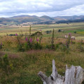
The Dodd and Wether Cairn from Alwinton

This walk explores the hills that lie just inside the southern boundary of the Northumberland National Park at the head of Coquetdale. The hills in the southern part of the Northumberland National Park offer some fine walking. This route starts from the small village of Alwinton and follows paths, tracks and quiet country lanes for the most part. However some sections are pathless and a good sense of direction is necessary. The walk is best avoided if low cloud is covering the hills. Also do be prepared for some boggy areas especially after rain.

Technical sheet

293291
A Alwinton walk posted on 04/07/16 by Walking Britain. Last update : 13/02/23
  • Walking
    Activity: Walking
  • ↔
    Distance: 15.16 km
  • ◔
    Calculated time: 5h 45 
  • ▲
    Difficulty: Difficult

  • ⚐
    Return to departure point: Yes
  • ↗
    Vertical gain: + 493 m
  • ↘
    Vertical drop: - 496 m

  • ▲
    Highest point: 558 m
  • ▼
    Lowest point: 154 m
  • ⚐
    District: Alwinton 
  • ⚑
    Start/End: N 55.350757° / W 2.128112°

  • Today’s forecast: … Loading…

Description

Start : Small carpark in the village of Alwinton. Grid ref. NT 919 063

(S/E) Exit the car park and turn left into the village passing the Rose and Thistle pub on your right. Continue straight ahead at the T-junction crossing the grass to locate a footbridge over the Hosedon Burn.

(1) Once over the bridge turn left along Clennell Street. Continue along this old track for about half a mile to reach a ladder stile on your right.

(2) Cross this and follow the path downhill to a footbridge over the River Alwin (grid ref. NT928070).

(3) Once across the bridge, turn left and follow the clear track upstream. Cross the river twice.

(4) About 200 metres past the second bridge, bear right up a track heading up the south ridge of the Dodd.

(5) After reaching the summit continue along the track as it turns East to reach two gates (grid ref. NT928098). Go through the gate on the left and continue ahead on a less obvious track across Puncherton Hill.

(6) Reaching another gate (grid ref. NT932100) continue straight ahead to join a much clearer track that leads you another gate (grid ref. NT939104). At this point resort to mak a beeline for Wether Cairn soon picking up a fence coming in from the left to reach a fence junction (grid ref. NT941115). Turn left and follow the path to the trig point and stone shelter on Wether Cairn summit and enjoy the views.

(7) To continue retrace your route to the fence junction and cross the stile and with the fence on your immediate left, follow the fence initially South-East and then South. There is no path although with care you can make good progress across rough ground to reach a sheep fold (grid ref. NT944101).

(8) Turn right here on an often indistinct path heading South-West. Go through the stile or adjacent gate and continue following a track South-West towards Puncherton. The OS map shows a bridleway across the fields immediately east of the farm. However, reaching the edge of the cultivated fields (grid ref. NT938097) pick up a track that continues around the cultivated area and turn South to pass the farm on the left and re-join the bridleway (grid ref. NT934094).

(9) The next objective is Old Rookland Farm. Leaving Puncherton Farm in a Southerly direction the route ascends gently with intermittent paths for most of the way despite a bridleway being marked on OS maps. With a little bit of trial and error pass through a gate at grid ref. NT935088 to reach Old Rookland Farm.

(10) Continue straight ahead (farm on your left) and descend to a gate (grid ref. NT.936087). Head across the next field curving to the right to reach the valley bottom.

(11) Cross over the stream (Rookland Sike) and head for a gate and adjacent stile. Then follow the path uphill to the saddle between Silverton and Clennell Hills. Continue downhill to the gap in the forestry at grid ref. NT931078 and continue straight ahead to locate a gate in the right-hand field boundary (grid ref. NT931076). Bear half right across this field towards a small plantation in the bottom right-hand corner of the field.

Go through the gate and follow the clear track down to the main valley track used as part of the outward route.

(3) Turn left and follow the track alongside the River Alwin as it flows downstream. You pass Clennell Hall on your left and soon join a tarmac lane. This leads back to the Alwinton (S/E).

Waypoints

  1. S/E : km 0 - alt. 159 m - Car park in Alwinton
  2. 1 : km 0.2 - alt. 161 m - Footbridge - Hosedon Burn
  3. 2 : km 0.72 - alt. 195 m - Ladder stile
  4. 3 : km 1.73 - alt. 177 m - Footbridge - River Alwin
  5. 4 : km 3.07 - alt. 204 m - Track towards Dodd
  6. 5 : km 3.9 - alt. 324 m - The Dodd
  7. 6 : km 4.8 - alt. 377 m - Puncherton Hill
  8. 7 : km 7.41 - alt. 558 m - Wether Cairn
  9. 8 : km 8.95 - alt. 383 m - Sheep fold
  10. 9 : km 10.23 - alt. 322 m - Puncherton
  11. 10 : km 11.21 - alt. 329 m - Old Rookland Farm
  12. 11 : km 11.58 - alt. 284 m - Valley bottom - Rookland Sike
  13. S/E : km 15.16 - alt. 161 m - Car park in Alwinton

Useful Information

Start : Small carpark in the village of Alwinton. Grid ref. NT 919 063

Parking : Small carpark in the village of Alwinton (grid ref. NT919063) where charges apply.

Terrain : The route paths and tracks with some rough walking across pathless terrain. The route does require the walker to have a good sense of direction and the relevant OS 1:25000 Explorer map to hand. Good visibility is also useful for route finding and provides some wonderful views across the National Park and surrounding countryside.

Always stay careful and alert while following a route. Visorando and the author of this walk cannot be held responsible in the event of an accident during this route.

Reviews and comments

3.7 / 5
Based on 2 reviews

Clarity of route description
3.5 / 5
Clarity of route map
4 / 5
Walk interest
3.5 / 5
Delphinium
Delphinium

Hi D.DOG,
I am sorry to read you encountered some struggles. I am going to see with the author on how to improve however do you have any suggestions yourself ? As you have the walk quite fresh in your head?

Thank you for your support

Enjoy your walks

D.DOG
D.DOG

Overall rating : 3.7 / 5

Date of walk : 11/02/23
Clarity of route description : ★★★☆☆ Average
Clarity of route map : ★★★★☆ Good
Walk interest : ★★★★☆ Good

Tracks were a little vague as described. Views from the Dodd were really nice. Don’t go on a wet day as there a few boggy areas.

Leeanneb
Leeanneb

Overall rating : 3.7 / 5

Date of walk : 10/09/18
Clarity of route description : ★★★★☆ Good
Clarity of route map : ★★★★☆ Good
Walk interest : ★★★☆☆ Average

I found this s difficult walk to do, unfortunately the weather was changeable and wet, the views were amazing, ground unlevel and boggy, I am not an experienced walker so a little out of my depth on this one

Other walks in the area

For more walks, use our search engine.

The GPS track and description are the property of the author.

Loading…