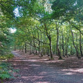
Start the walk at Notton Village Green.
(S) At Notton Village Green walk past the Post Office and continue up Applehaigh Lane out of the village. On reaching a fork turn right passing in front of a row of cottages and along a grass path to enter the attractive wooded area of Applehaigh Clough. Follow the path alongside a beck to the first footbridge. Cross the beck and turn left along the path. Turn right at the edge of the wood and continue along the edge of a field. The path bears left and crosses the field in a diagonal direction towards houses and a road beyond. Turn left and left again down Keeper Lane and continue to the A61.
(1) Cross the road and turn left along the footway. Turn right and walk up Warren Lane until you reach a pair of old stone gateposts into the wood on the right, which mark the start of a bridleway. Follow this path through the wood and on to Mount Farm and Woolley Park Golf Club.
(2) On reaching New Road, cross and turn left along the footway to Woolley village. Just before the village green turn left along a footpath, cross a field and go through the church grounds to the road. Turn left for a short distance, then right along Middle Field Lane. Continue along the road to a stile on the left and cross the field to Gypsy Lane. Turn right and continue to Woolley Edge Lane.
(3) Cross over to a broad verge and turn right. Take the signposted path on the left which drops into the wood. Continue straight down the path and bear right past Near Moor Farm and on to a road (Haigh Lane). Cross and turn left. Continue down to the M1 and cross to the A637 and continue along the footway, to reach the Bretton Country Park carpark. Continue through the park and bear right up to the Visitors’ Centre where buses are available to Wakefield or Barnsley. (E)

