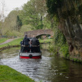
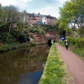
(S/E) Start from the Whittington Horse bridge. To get to here if driving you would need to park on Dark Lane and follow the road down to the canal or park in Kinver proper and join the canal from The Vine pub. Walk along the canal for around 4km until you reach the Cookley tunnel.
(1) You may climb the steep path just before the tunnel or venture through the tunnel and then take the slightly less steep track up to Cookley village. From here, if you want to make this a much shorter walk you can take the road to Kinver/Caunsall for a short distance and join the return path as you cross the bridge over the stream. You may also wish to continue along the canal and re-join this route at The Lock Inn. To continue with the longer version, if you climbed the first path from the canal, turn left. You will shortly pass two pubs. Opposite Eagle and Spur is the Cookley Clock on Elizabeth Bache Corner.
(2) Take the road to the right of this clock. Continue along this road which runs parallel with the canal which will be on your right. Just after a sharp bend in the road you take a right over a bridge over the canal then take the footpath first left back down to the canal. Follow the path to The Lock Inn.
(3) At the car park, turn right and then right again after passing the crazy golf course. This takes you into Wolverley.
(4) Pass the Queens Head pub if you can to carry on out of the village up a lane with traffic lights controlling vehicles through a narrow bit of road. On the right is a no through road sign. This sign is for cars. Enter the road and shortly after you will join the footpath. This is a straight path to Gloucester Coppice. From here, the river Stour will be lower down on your right. Keep the fence to your right while walking through Debdale Farm. Here is a riding school and you may come across the occasional loose horse. At the bottom of a very short but steep hill is a stile leading you through the school.
(5) Turn left out of the school and join a gravel road running parallel with the river until you meet the road to Caunsall and anyone that took the shorter route. From here it is one road which passes through the village passing another pub The Anchor.
(6) Keep on this road until you meet the canal. Turn left onto the footpath making your way back to the Whittington Bridge or carry on to the next lock and The Vine at Kinver.(S/E)


