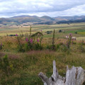
Brough Law, Cochrane Pike and Turf Knowe

Escape the hordes and enjoy some archaeological delights

Technical sheet

10244434
A Ingram walk posted on 06/06/21 by Walking with Adam. Last update : 22/12/21
  • Walking
    Activity: Walking
  • ↔
    Distance: 8.29 km
  • ◔
    Calculated time: 3h 15 
  • ▲
    Difficulty: Moderate

  • ⚐
    Return to departure point: Yes
  • ↗
    Vertical gain: + 301 m
  • ↘
    Vertical drop: - 295 m

  • ▲
    Highest point: 334 m
  • ▼
    Lowest point: 136 m
  • ⚐
    District: Ingram 
  • ⚑
    Start/End: N 55.441241° / W 1.989045°

  • Today’s forecast: … Loading…

Description

(S/E) From Bubly's Wood car park entrance turn left and follow the road for about 30 m. Then turn right onto a track after a 100 m bear right to gain the Hillfort Trail. Continue steeply uphill past two benches, just after field corner bear right at a fork to visit the fort.

(1) Depart fort in a southernly (left) direction and rejoin the Hillfort Trail. (NB course is different from the path shown on the OS map). Carry on straight ahead at the junctions.

(2) Cross a stile or go through gat and decent to another fort with a fence on you right. Turn left.

(3) Then turn hard right cross a fence continue for 30 m then turn left to cross another fence, continue up hill to Cochrane Pike.

(4) When reaching Cochrane Pike, turn left at sign post, descend hill bear right to visit another settlement.

(5) Exit the settlement and descend very steeply go through gat and then another.

(6) From this point the permissive path that had been previously well signposted all but disappears. Go through a gate and then cross a stone slab bridge, turn up hill then left and head towards a wooden post, pass through a Settlement to join a bridleway.

(7) Turn right on the bridleway then turn left on the Hillfort Trail again.

(8) Turn right and walk along an old wall to Turf Knowe then descend to the field corner.

(9) Turn left along another old wall to road. Turn left and return to the car park. (S/E)

Waypoints

  1. S/E : km 0 - alt. 136 m - Bubly's Wood car park
  2. 1 : km 1.16 - alt. 282 m - Hillfort Trail
  3. 2 : km 3.22 - alt. 273 m - Stile
  4. 3 : km 3.42 - alt. 258 m - Fence
  5. 4 : km 4.2 - alt. 333 m - Cochrane Pike
  6. 5 : km 5 - alt. 297 m - Settlement
  7. 6 : km 6.06 - alt. 195 m - Stone slab bridge
  8. 7 : km 6.54 - alt. 248 m - Hillfort Trail
  9. 8 : km 6.98 - alt. 266 m - Turf Knowe
  10. 9 : km 7.75 - alt. 156 m - Old wall
  11. S/E : km 8.29 - alt. 137 m - Bubly's Wood car park

Useful Information

Note some Forestry works scheduled to finish in June 2021 might change the start of the walk slightly

Always stay careful and alert while following a route. Visorando and the author of this walk cannot be held responsible in the event of an accident during this route.

Reviews and comments

5 / 5
Based on 1 review

Clarity of route description
5 / 5
Clarity of route map
5 / 5
Walk interest
5 / 5
Swazel
Swazel

Overall rating : 5 / 5

Date of walk : 04/03/24
Clarity of route description : ★★★★★ Very good
Clarity of route map : ★★★★★ Very good
Walk interest : ★★★★★ Very good

Walked this route today, no problems along the route- lovely walk, thank you!

Other walks in the area

For more walks, use our search engine.

The GPS track and description are the property of the author.

Loading…