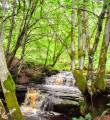
Benwhat Monument from Dalmellington
This walk goes up Benwhat Monument from Dalmellington past the heritage of an old mining village.
Description
Start : Craigmark Store, public house (KA6 7PU). Grid ref. NS 473 071
(S/E) From Craigmark Store, public house. Head up the lane to the left (North-West), passing the old tyres.
Follow up onto old opencast area. Take the road going straight up, you should see a large green container further up. The road bends to the left passing some very large tyres.
(1) Once at the crossroads, go straight ahead, signposted Benwhat. Continue to follow the road passing through a gate with two old vehicles on either side.
(2) Turn right and follow the road uphill. Once at the top, there are personal monuments and benches to remember loved ones who lived in this old mining village, please be respectful, carry on the dirt track/quad tracks to the right stopping at the fence.
Turn left, and follow the fence all the way to the corner where it breaks right. It may be marshy at the post marked with red tape, can easily be passed with careful foot placements.
(3) Once passed, turn left and walk towards the monument, just slightly going uphill, aim between the two high points on either side. The monument will be in front of you at Benquhat Hill.
(4) From the monument, return the route using the same way. (S/E)
Waypoints
- S/E : km 0 - alt. 185 m - Craigmark Store, public house
- 1 : km 0.45 - alt. 206 m - Crossroads
- 2 : km 2.56 - alt. 273 m - Two old vehicles on either side
- 3 : km 4.25 - alt. 401 m - Post marked with red tape
- 4 : km 4.61 - alt. 426 m - The monument
- S/E : km 9.22 - alt. 185 m - Craigmark Store, public house
Useful Information
Start : Craigmark Store, public house (KA6 7PU). Grid ref. NS 473 071
Parking : Park across from Craigmark Store, public house. (Please be respectful when parking not to block any roads. Plenty of room for a few cars against the fence).
Alternatives :
There is another path directly to the monument just passed the Entrance stone, but it can be very marshy at times.
Walk can also be started from the carpark next to all weather pitch across from Jet Garage. Follow the signposts for Burnton, staying on the road passing the building at the corner of Burnton Brae towards the Public House.
For more information contact Doon Valley Walkers here.
As with all walks, please remember the Scottish Outdoor Access Code.
Always stay careful and alert while following a route. Visorando and the author of this walk cannot be held responsible in the event of an accident during this route.


