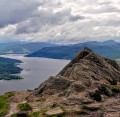
Ben Ledi

A lovely Scottish summit in the Trossachs. Great for lovers of romantic landscapes and moderately sporty excursions.

Technical sheet

4098891
A Stirling walk posted on 16/06/16 by Ren38. Last update : 07/07/16
  • Walking
    Activity: Walking
  • ↔
    Distance: 9.42 km
  • ◔
    Calculated time: 4h 45 
  • ▲
    Difficulty: Moderate

  • ⚐
    Return to departure point: Yes
  • ↗
    Vertical gain: + 725 m
  • ↘
    Vertical drop: - 723 m

  • ▲
    Highest point: 856 m
  • ▼
    Lowest point: 127 m
Shortly after the start of the walk
View from Ben Ledi
From the summit before beginning the descent
The summit with a line of pickets

Description

Start at the car park located along the road from Callander in Fort William (A84). This inconspicuous and poorly-marked car park is to the left just before Loch Lubnaig.

(S/F) Take the path that goes diagonally down the slope and through a partially de-forested area. In the direction of west-north-west. Reach a forest road.

(1) Cross it, reach a wide turn.

(2) Continue on the path towards the west to reach a section in the fence designed to allow you to pass it.

(3) Step over a stream, then continue uphill for 700 m to reach the 590 m marker.

(4) Head around the mountain range to the left and continue to climb north-west on a path that is not always very visible reach Ben Ledi. Stop a moment to admire the scenery if the weather is clear.

(5) Continue north-west, then north walking on a very rounded ridge. This path that heads gently downhill is lined with iron stakes.

(6) Begin the steep descent (north-north-east) through the rocks and in the grass trying to avoid the wet bogs. Head generally in the direction of the forest roads that can be seen below.

(7) Cross a fence bridle and join up with the well-marked path. Follow this path that ultimately leads into the undergrowth. Cross a logging road twice.

(8) Finally, take the logging road that goes down to the loch.

(9) Then follow the road (no traffic permitted except for residents) or the bike path (both lanes run parallel to each other) running almost flat to the car park at the start (the loch is on your left) (S/F).

Waypoints

  1. S/E : km 0 - alt. 131 m
  2. 1 : km 0.69 - alt. 255 m - Forest path
  3. 2 : km 1.12 - alt. 360 m - Wide turn
  4. 3 : km 1.5 - alt. 431 m - A crossing place in the fence
  5. 4 : km 2.21 - alt. 589 m - Head around the mountain range
  6. 5 : km 3.79 - alt. 855 m - Ben Ledi
  7. 6 : km 4.37 - alt. 820 m - Steep descent
  8. 7 : km 5.72 - alt. 382 m - A crossing place in the fence
  9. 8 : km 7.42 - alt. 198 m - Forest trail
  10. 9 : km 8.11 - alt. 135 m - Road and bike path
  11. S/E : km 9.42 - alt. 133 m

Useful Information

Always bring warm windproof clothing because at the top the conditions can be very harsh (wind, rain, fog).

Like most hikes in Scotland, there are very few signs or markings indicating the path.

For this hike, the path is not visible all the way and in poor weather you will not meet many people.

Always stay careful and alert while following a route. Visorando and the author of this walk cannot be held responsible in the event of an accident during this route.

During the walk or to do/see around

Take the opportunity to visit the charming little town of Callander. If you have plenty of time tour the lochs by car (including Loch Katrine which inspired "The Lady of the Lake" by Sir Walter Scott)

Other walks in the area

For more walks, use our search engine.

The GPS track and description are the property of the author.

Loading…